Watermark Round Britain Voyage Summer 2015 and Boat Beacon AIS

Watermark is a Beneteau First 33.7 Cruiser/ Racer  currently on a round Britain voyage.  She is using Boat Beacon to share her position over internet AIS with friends and family on Boat Watch and our new live iframe “embed” web page that lets you add a map showing your boat’s location to other web pages (e.g. a blog). Use the following as a template, you can set the width and height to fit your page

“<iframe style=”border:none;height:600px;width:1800px;” src=”http://boatbeaconapp.com/see/MMSI?embed=1″></iframe>”

Where MMSI is your boat’s MMSI number (as set in Boat Beacon). If you don’t have an MMSI, we can provide you with an internet AIS one, or you can use your Boat Beacon identity instead starting with BB (see the bottom of My Boat Details in Boat Beacon to find your Boat Beacon id). If you don’t have  blog or web site you can also give out a web link to your web page on our site – e.g. http://boatbeaconapp.com/see/MMSI

We wish Malcolm and Watermark a safe and very enjoyable circumnavigation and look forward to following their progress. Here is his current postion :-


Apple Watch – Pocket Mariner apps

We have been working hard to ensure Apple Watch versions of all our marine apps are ready for you as soon as you get your new Apple Watch. Boat Beacon, our signature app, now gives you collision alerts directly on your wrist with CPA time and distance information and a map overview. Check your next waypoint wherever you are on your boat with a compass view, cross track error (XTE), distance and ETA on our SeaNav watch app.  Spot nearby boats, track your ferry or a boat of interest and get arrival and departure alerts with our Boat Watch app on Apple Watch.


PocketMariner_SeaNav_on_Apple_Watch_aPanbo-thumb-465xauto-11115

SeaNav and Boat Beacon Navigation view


iOS Simulator Screen Shot - Apple Watch 16 Mar 2015 16.15.02


SeaNav Waypoint face.


iOS Simulator Screen Shot - Apple Watch 16 Mar 2015 16.16.59


Boat Beacon and SeaNav Compass view


iOS Simulator Screen Shot - Apple Watch 16 Mar 2015 17.15.53


Boat Watch, Boat Beacon and SeaNav map AIS view

iOS Simulator Screen Shot - Apple Watch 16 Mar 2015 17.41.07


As ever – ship photos to help you identify it.

iOS Simulator Screen Shot - Apple Watch 16 Mar 2015 17.49.20


And the great news ….. the watch apps are all free upgrades to our existing apps 🙂

Melbourne to Port Fairy Ocean Yacht Race

Pocket Mariner are pleased to be sponsoring the  ORCV’s (The Ocean Racing Club of Victoria) Melbourne to Port Fairy Ocean Yacht Race this Easter. We are providing complimentary copies of our Boat Beacon app to all the entrants and race officials so they can track the fleet over the 135 mile race.

You can view and see the tracks for all the boats live here

http://boatbeaconapp.com/group/ORCV 2015 PORT FAIRY

We have also set up 5 Artificial Aids to Navigation for the start and finish of the race, marking Drapers Reef at the start line, ORCV Virtual Buoy, Point Lonsdale Light, Corsair Rock  and Nunn buoy at the finish line.

The AtoN’s are visible in Boat Beacon and our Boat Watch apps.

IMG_3740


You can read more about the AtoNs for the race on the ORCV web site here:-

http://www.orcv.org.au/index.php/port-fairy/4413-boat-beacon-ais-smartphone-tablet-app-aids-to-navigation

New AIS Aerial in the Caribbean on St Barts

Our latest AIS aerial  on St Barthelemy in the Caribbean has just gone live. If only I could go out and test it! Thanks to Emmanuel at Jicky Marine Service

http://boatbeaconapp.com/station/7017

Screen Shot 2015-03-25 at 16.07.12


Our AIS aerial on top of Jicky Marine Service’s office.

FullSizeRender (3)


Jicky Marine’s office from the other side of the Harbour


FullSizeRender (4)


Plan of Gustavia  looking from the land side out to sea (North is bottom right) showing the office location.


New AIS Aerial at Davidstow Airfield, Cornwall

As part of the ongoing work to improve our global AIS coverage we have installed a new AIS aerial to provide better real time coverage for the seas around Cornwall in the UK.  There is a disused airfield at Davidstow. It was Coastal Command’s highest airfield in the UK at 300m (1000′) above sea level; a perfect place to get a long range view of the surrounding sea,  to the North, West and South of Cornwall.  We used a Digital Yacht AIS Net base station for the AIS receiver with a Shakespeare 6db AIS tuned aerial. There is no internet connection at the museum so we used a Huawei E3551 3G dongle and the excellent EE 3/4G data service to backhaul the AIS data to our servers.  You can check the live coverage from the new aerial here:-  http://boatbeaconapp.com/station/5353

Here is my son installing the aerial on the tower at the airfield.

image1


The DY AIS receiver hooked up at the base of the aerial.


image2


and live ships –  10,000 square miles of coverage including two major ports at Falmouth and Plymouth 🙂

Screen Shot 2014-10-07 at 16.56.24

Many thanks to Steve at Davidstow Airfield and Cornwall at War Museum who is kindly letting us use his tower to mount the aerial on  (giving us another 12m (40′) of elevation 🙂 . The museum is very well worth visiting if you are in the area and even if you are not.

Transas iSailor app now powered by Pocket Mariner’s live AIS service

Pocket Mariner’s real time AIS data and photo API service has been selected by Transas , a global leader in marine navigation systems, to use with their iSailor iPhone and iPad app. The latest version 1.7.0 of their app  now provides a real time map view of ships around you with instant details including name, range and bearing together with a photo of the ship to help you recognise it.

You can get the latest version of  iSailor from the app store now

IMG_0022           Mikhail Andrianov, Product Manager at Transas says “We are really excited to provide our Transas iSailor users with live AIS data on their charts via the Internet. Pocket Mariner’s live AIS API, SDK and sample code made integration with our product easy and fast. This option makes it possible to show on charts the next AIS target types: AIS Class A, AIS Class B, AtoN (Aids-To-Navigation, virtual or real), Shore Base Stations. This functionality will be useful for users of different kinds: from sailors, boaters or water tourists, – who have no AIS Class B or receivers on board to ship owners, dockers and marine logistics personnel, who need to monitor vessel traffic in a given area. To use this functionality, you will have to have WiFi, 3G or 4G/LTE internet access on your Apple device.” Steve Bennett, Pocket Mariner’s CEO commented: “This is another great endorsement of Pocket Mariner’s “real time” AIS data service and API’s that we use to power our own Marine Navigation Apps and we look forward to providing additional AIS data services enabling Transas’ iSailor users to share their boat’s position and course in real time using our internet AIS transmit and track api’s”.   IMG_0052

Portsmouth Pilots choose Pocket Mariner’s AIS Live and Replay services

Pocket Mariner’s real time AIS data service, FleetWatch,  has been selected by the Pilots at Portsmouth International Port  to use with their Portable Pilot Units (PPUs) running SevenCs ORCA Pilot G2 solution.  The Pilots use Pocket Mariner’s real time enhanced AIS data feed to display live ship positions and courses on and around their client’s ship as they travel out to pilot it. The enhanced feed ensures all the vessel information including name (so you can call the ship via VHF radio) and dimensions is instantly available as soon as the PPU connects unlike VHF AIS where it can take several minutes to acquire the extra data. Ben McInnes, Harbour Master and Portsmouth Pilot said: “The real time internet AIS feed allows us to “virtually board” the ship and assess the situation before we even get there.” Portsmouth have also selected Pocket Mariner’s AIS Replay service to review and playback incidents and for training purposes.
Steve Bennett, Pocket Mariner’s CEO commented: “This is a great endorsement of Pocket Mariner’s “real time” AIS data service that we use to power our own Marine Navigation Apps and we look forward to them using our additional AIS data services including geo-fence event triggering and instant history replay capabilities “.
Please contact us at business@pocketmariner.com to learn more about how our FleetWatch and PortWatch service can help you.
Here is a screenshot of live ship traffic around Portsmouth using the Pocket Mariner AIS service and SeaNav charting app:-
IMG_0284
To learn more about Pocket Mariner’s AIS data services, SDK and API’s please email us at business@pocketmariner.com

New NAVIOTAB+ tablet with built-in Boat Beacon for AIS


We have been working with IntelliWeather Inc. who have been developing an exciting new marine-rated rugged and waterproof navigation tablet device. The device is now launched and we are delighted they chose to build in our Boat Beacon AIS – Marine Navigation app  to provide a fully operational AIS collision avoidance system. Here are some more details on this exciting new device.


NAVIOTAB

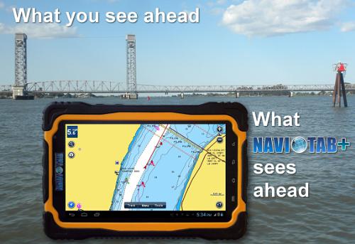
A new IP66 rated waterproof and dirtproof Android tablet for marine use provides an all-in-one solution at a fraction of the cost of traditional separate marine electronic devices. It provides navigation, AIS collision avoidance, weather radar, weather bulletins, communications, entertainment, and optional fish finder/sounding capability in one portable device.

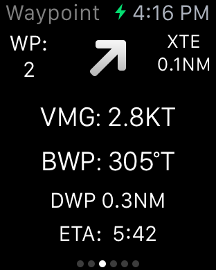
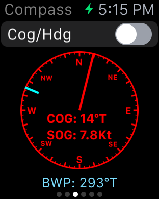
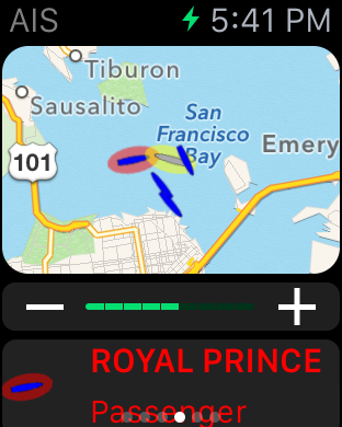
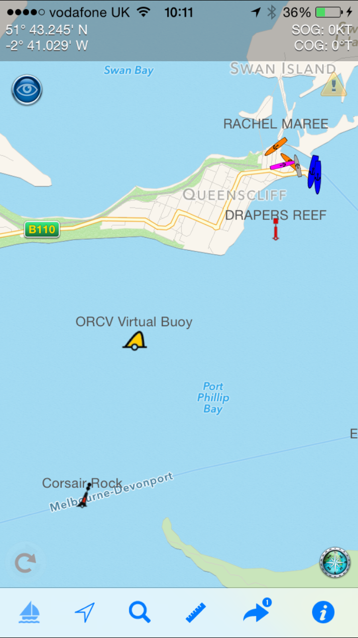
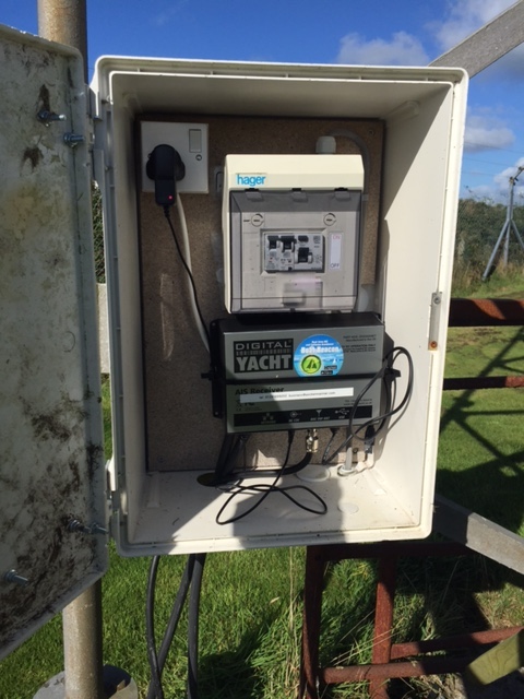
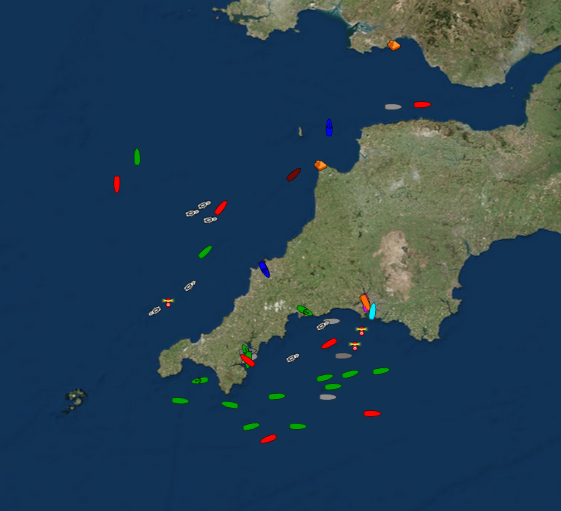
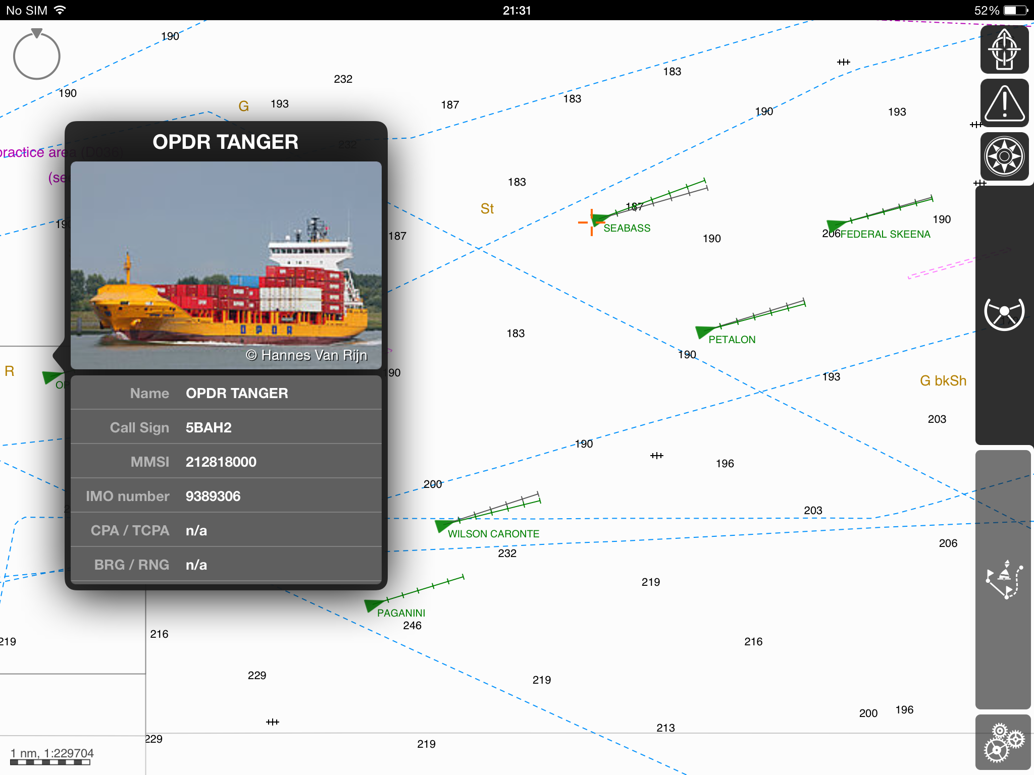
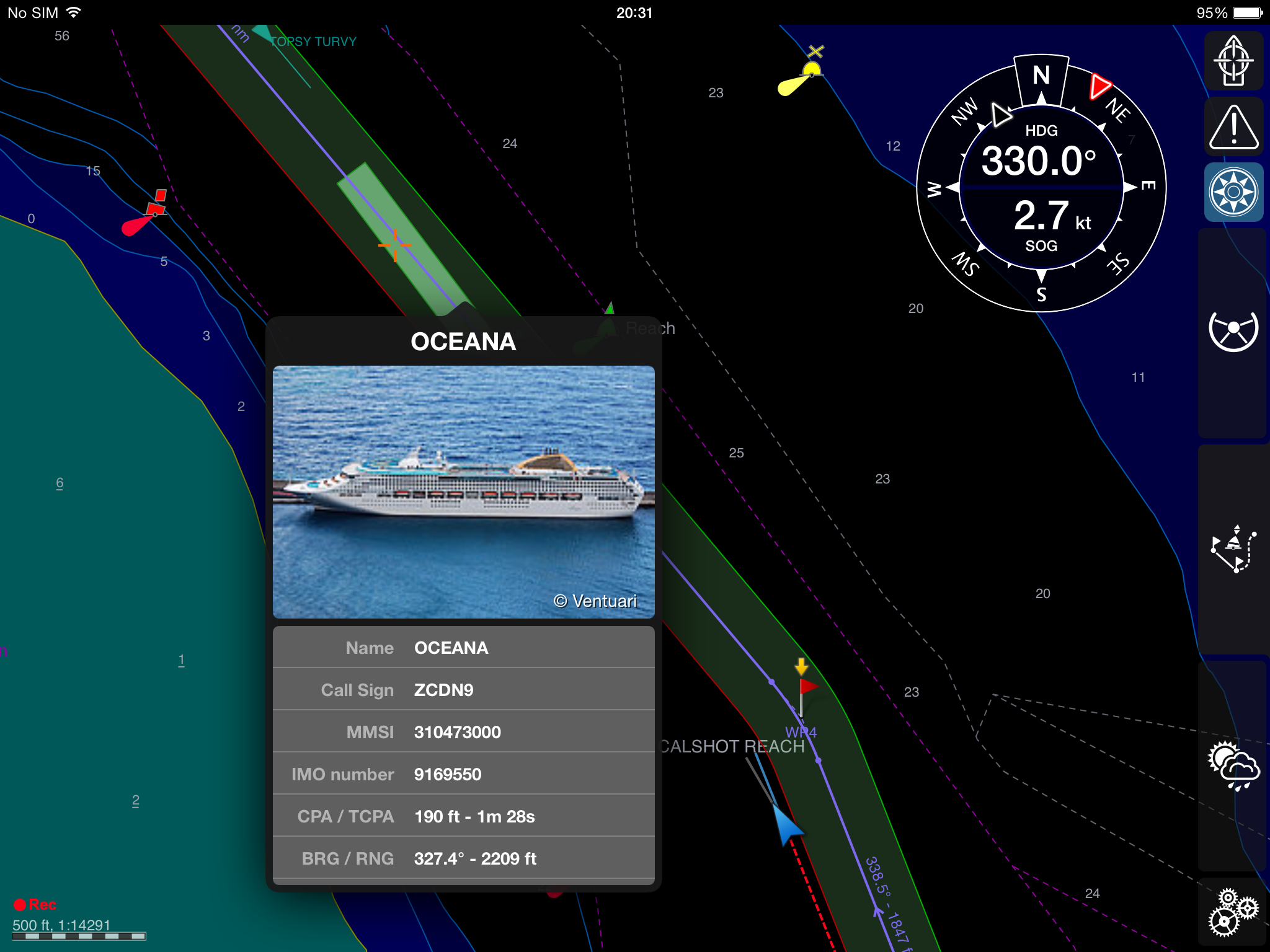
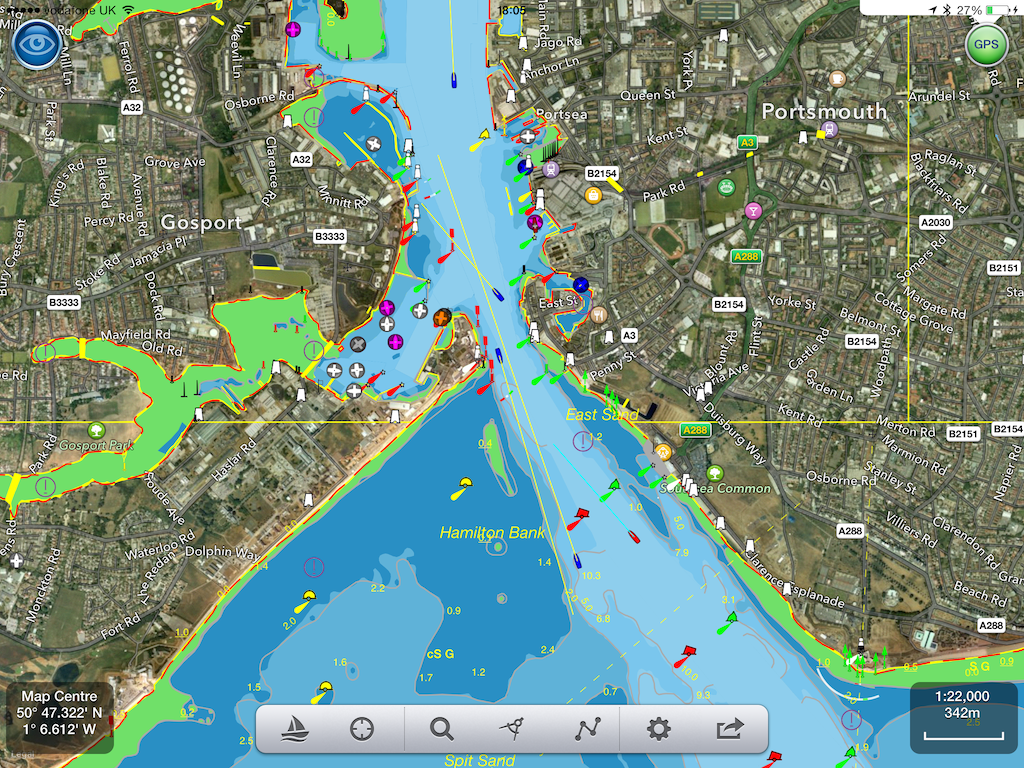
The NAVIOTAB+ tablet has been introduced by IntelliWeather Inc., a provider of weather instrumentation, weather display systems, and weather content and comes pre-loaded with ready to run applications and navigation charts for the United States. The user has options to purchase additional navigation charts for most regions of the world provided by Navionics. In addition, in an agreement with PocketMariner of the United Kingdom, the NAVIOTAB+ comes ready to use with a fully operational AIS collision avoidance system. Making use of the built-in GPS and Internet connectivity capabilities to provide a real-time AIS radar like display of vessels near your position in highly trafficked ports and navigable waterways worldwide. This provides an extra level of accuracy and protection allowing you to “see and be seen” with or without MMSI registration.

The NAVIOTAB+ also comes equipped with free weather radar plots and weather bulletins in the USA, including marine weather bulletins. The data is provided free by NOAA and has no subscription requirements. All that is required for live weather radar data and live AIS is an Internet connection via the built-in 3G/4G data capability of the NAVIOTAB+. This can be via a SIM card and most any cellular data carrier that supports a “bring your own” plan for connectivity. Alternately, NAVIOTAB+ can communicate via any 3G/4G capable cellphone that is WiFi hotspot enabled, or any other WiFi Internet connection.

When equipped with a SIM card and cellular data/voice plan, users can initiate and receive telephone calls using the built-in speaker/microphone, earphone, or use a Bluetooth enabled speaker or headset like they would with any cell-phone. Web browsing, email, and MMS messaging are also standard features.

As an entertainment system, NAVIOTAB+ provides a built-in FM radio tuner as well as streaming music services such as Pandora Internet Radio (free) and Sirius XM radio (subscription). Both come installed and can be operated without external antennas. Movies can also be played from streaming services such as YouTube, Netflix, Hulu, and others as well as locally stored files.

Unlike traditional marine electronics, the NAVIOTAB+ is not married to your boat, it can be taken “on the go” anywhere as a regular tablet and can also serve as an automobile navigation system via the built-in Google Maps application.

To round out the features, with the addition of a DEEPER Bluetooth enabled transducer, fish finding, water temperature, and depth sounding capability can be added to the NAVIOTAB+.
A powerful 10,000 mAH Lithium-Ion battery provides operation which can exceed 8 hours. The tablet can also be continuously charged/powered directly from your boat via the included Blue Sea Systems marine rated 12 volt cigarette lighter to USB power adapter and the included USB power cable.
Sporting a Quad-core 1.2 GHz A9 processor, 1 GB of RAM, and 8GB of FLASH storage, the NAVIOTAB+ is fast and responsive. Storage can be expanded up to an additional 32GB with insertion of a micro SD storage card. The bright 7″ screen is protected by toughened scratch resistant glass and can be seen in daylight, plus offers automatic dimming for night use. The built-in GPS receiver system does not require an external antenna, and is accurate to within 3 meters (10 feet).
Weighing just 1.36 pounds, NAVIOTAB+ is easily portable, and easy to secure to windshields, dashboards, and rails with a wide variety of readily available tablet mounting systems. It also comes with a palm rest/strap to enable portable use.
Tally up and compare the cost of all the separate marine rated devices that are replaced by the NAVIOTAB+ and you’ll understand why it makes the most sense for the recreational boater that doesn’t want to spend a fortune on getting their boat equipped. For the professional mariner, NAVIOTAB+ also makes a great backup system for your bridge, or as an emergency navigation system.
The NAVIOTAB+ has a manufacturer’s suggested retail price of $649.00.

Dealer inquiries are invited.

For further information these resources are available.

PRODUCT WEBSITE: http://naviotab.com

SPEC SHEET: http://naviotab.com/docs/NavioTab+_flyer.pdf


Navionics Boating (free US NOAA Charts) vs SeaNav

Navionics have  launched a new version (7.0) of their Navionics Boating app which now includes free US NOAA vector charts. If you are boating in the US you can now get a well respected and functional marine navigation app on your iPad and iPhone without spending a cent. What are they up to? Why should you go anywhere else? How can they give away a full blown marine navigation app for free? We hope the following comparison  and charts around San Francisco can help you decide which route to follow.

Here is the view of San Francisco from SeaNav within a 3 mile radius  – the horizon for most leisure boat users (6NM x 6NM square) :-

and the same scale on Navionics Boating with their free NOAA charts :-

What?

We zoomed in and eventually (at three times the scale) details appeared:-


Compare this with SeaNav at the same scale:-

We hope you will agree that its a lot less cluttered, has more relevant information and is a lot easier to view. Zoom in and more details and spot depths will be shown. You can also choose what level of detail to show in SeaNav.

Other key differences:-

  • SeaNav includes full live navigation features including COG, SOG, HDG, ETA, Waypoint distance and time, Cross Track error, Course and North up view etc. – it’s at least a $5 extra for Navionics and that doesn’t get you much of what SeaNav offers.

  • SeaNav includes Tides – Navionics Boating free doesn’t – you have to buy their  USA chart set  at $70.

  • SeaNav has a unique and highly recommended AR Camera view showing buoys, ships, landmarks  etc. overlaid on the real time camera view.

  • SeaNav has free support for the amazing fully waterproof Pebble SmartWatch – forget a $500 Garmin Quatix!

  • SeaNav has live AIS Ship data overlay including collision detection. (via Boat Beacon).

  • SeaNav – buy once  and runs at full HD on both your iPad and iPhone with no need to purchase another version.

  • SeaNav including full charts is just $19.99 in the US and £14.99 in the UK. See how this unfortunate user ended up paying over £70 ($100) for Navionics “Free”:-

And, SeaNav iPhone and iPad is now available for you to try for free. Click here to learn more.

(SeaNav is also available for Mac)

Boat Beacon now supports AIS and GPS from a VHF AIS receiver.

Boat Beacon now allows you to use AIS and GPS NMEA data directly from an AIS receiver and GPS on-board your boat via WiFi (over UDP or TCP) or Serial(USB). Boat Beacon seamlessly combines this with the AIS information it receives over the internet. If  you travel outside mobile internet coverage or in an area where we don’t have good coverage from a local shore station, Boat Beacon can now continue to work displaying live ship data, calculating Closest Point of Approach (CPA) with alarms etc. from your VHF AIS receiver or AIS enabled VHF radio. On Android you can connect  the  NMEA  serial  or usb output from an AIS receiver or connect via WiFi. On iPhone you need to use WiFi. Here are some of the AIS receivers we have tested with  Lowrance, Simrad, B&G, Digital Yacht, Comar NMEA-w2-Wifi, Weatherdock EasyAIS, Chetco Digital SeaSmart , dAISy AIS, Navico GoFree, Quark AIS (dual channel and usb stick)  etc. More information on how to hook all this up is given below.

 iPhone and Android AIS and GPS over WiFi.

If you already have AIS data available over Wifi on board then just enter the UDP port number (or ip address and port number for TCP) for the source and Boat Beacon will start using the data. With Navico GoFree and iPhone/iPad this is even more simple as there is a “GoFree” connect button in settings – just press and go.  If you only have a usb or nmea output available you will also need a serial or usb to internet or Wifi adaptor. They range in price from $50 to $200. This is one example we have tested with at the $70 level – USR-TCP232-400 that we hook into our on-board WiFi hub.

Here are some specific instructions for connecting Boat Beacon on Android to GoFree – http://pocketmariner.com/?p=1538

Android AIS NMEA 0183 and GPS over USB or serial

Boat Beacon will automatically launch and use local AIS  data (and GPS if available)  when a USB cable is plugged in between the AIS receiver and your Android device. You can set the USB mode on or off in settings in Boat Beacon.

For an Android NMEA 0183 connection you will need the following:-

1. An Android device that supports USB host mode (typically OS3 or later)
2. If your receiver doesn’t have a USB output you can simply convert the NMEA 0183 2 wire  output to USB for a few dollars more using an RS232 to USB cable. Typically $7 or so.  The most common USB to RS232 cables use the Prolific 2303 driver which we support. The cable we tested with is this one :-
We also support many other serial usb drivers (see below).
3. You will also need an Android OTG micro usb adaptor which only cost a couple of dollars. Here are a couple of links to the type of OTG micro usb adapter you will need:-
and this one allows you to charge your device at the same time:-
20 cm Micro USB OTG Y-Cable + extra power supply http://www.amazon.co.uk/dp/B00EJP5XR2/ref=cm_sw_r_tw_awdl_adfhtb0B8YQ4B via @amazon

More information.

You can get Boat Beacon from the iTunes or Android stores – Boat Beacon

If you have a problem connecting with Android over usb you can run this free simple serial usb tester program on your Android device once you have an OTG adaptor to report and test what driver is required and let us know :-
http://boatbeaconapp.com/ybw/app/usbtest.apk (just click on the link on your tablet to download the app).
Please email us if you have any questions or suggestions at support@pocketmariner.com
There is also a great article here about hooking up NMEA to serial :- http://cms.nobeltec.com/CMS/Files/Connecting%20instrument%20serially%20to%20the%20computer.pdf