
AISWatch new features
We have added 3 new features to our commercial AISWatch services for 2016. Mobile geofences, history replay extended to up to a week at a time and GIS information overlays. More about these features below. Please contact us if any of these may be of interest to you support@pocketmariner.com or phone +44 1291 689202
Mobile Geofences
Attach geofences to moving ships providing a closest point of approach (CPA) or Exclusion zone around it. As with the existing geofences these can be quickly added and monitored on the fly via the AISWatch live chart view. Geofences turn red when they have been triggered.
History replay extension
You can now select from 1 hour up to 7 days of AIS history replay and playback at up to 60x real time (1 minute in 1s) in AIS mode.
Graphical information overlays (GIS)
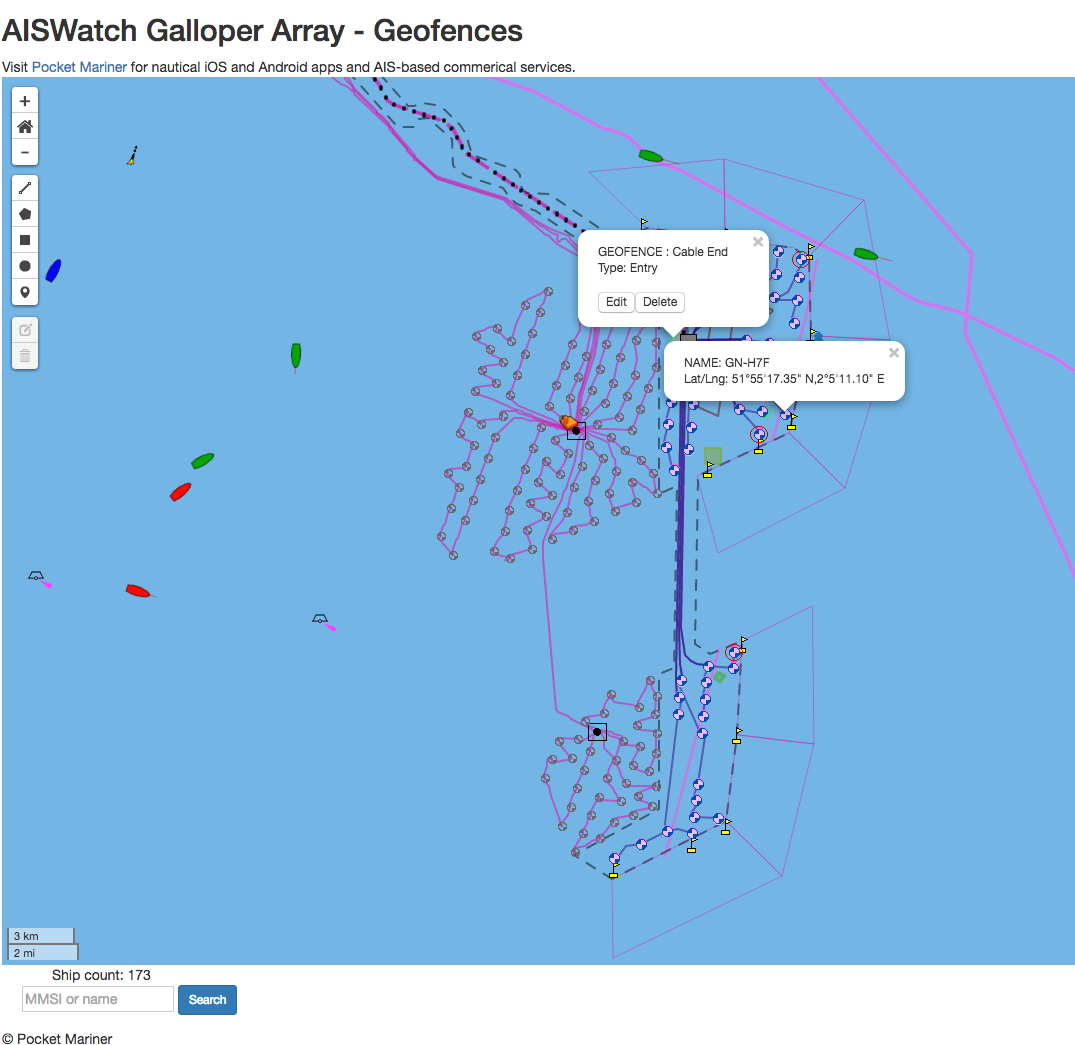
Add points, shapes and areas with names and labels on top of the map and charts. AISWatch can now import geographical features from most GIS formats. For instance mark the sites of new Wind-farm turbine installations, where power cables are running, mark a wreck or danger zone, mark a dredging area etc.
Please contact us if any of these may be of interest to you support@pocketmariner.com or phone +44 1291 689202