
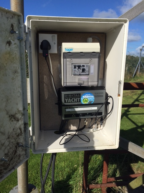
As part of the ongoing work to improve our global AIS coverage we have installed a new AIS aerial to provide better real time coverage for the seas around Cornwall in the UK. There is a disused airfield at Davidstow. It was Coastal Command’s highest airfield in the UK at 300m (1000′) above sea level; a perfect place to get a long range view of the surrounding sea, to the North, West and South of Cornwall. We used a Digital Yacht AIS Net base station for the AIS receiver with a Shakespeare 6db AIS tuned aerial. There is no internet connection at the museum so we used a Huawei E3551 3G dongle and the excellent EE 3/4G data service to backhaul the AIS data to our servers. You can check the live coverage from the new aerial here:- http://boatbeaconapp.com/station/5353
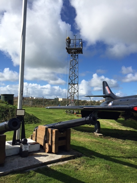
Here is my son installing the aerial on the tower at the airfield.
The DY AIS receiver hooked up at the base of the aerial.
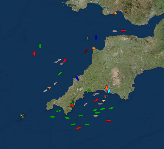
and live ships – 10,000 square miles of coverage including two major ports at Falmouth and Plymouth 🙂
Many thanks to Steve at Davidstow Airfield and Cornwall at War Museum who is kindly letting us use his tower to mount the aerial on (giving us another 12m (40′) of elevation 🙂 . The museum is very well worth visiting if you are in the area and even if you are not.