Track and record boat races with BoatBeacon groups

You can now track, record and replay races with Boat Beacon on Android and iOS using groups and the following web page:-

https://boatbeaconapp.com/ais/race/MYGROUPNAME

Where MYGROUPNAME is your group name. The group hashtag name is anything you like up to 20 capital letters (no spaces). Set your group name in Boat Beacon/Settings/My Trip Details.
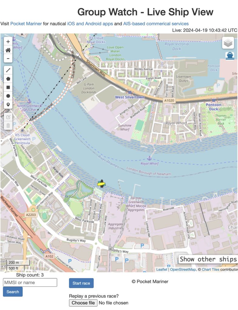
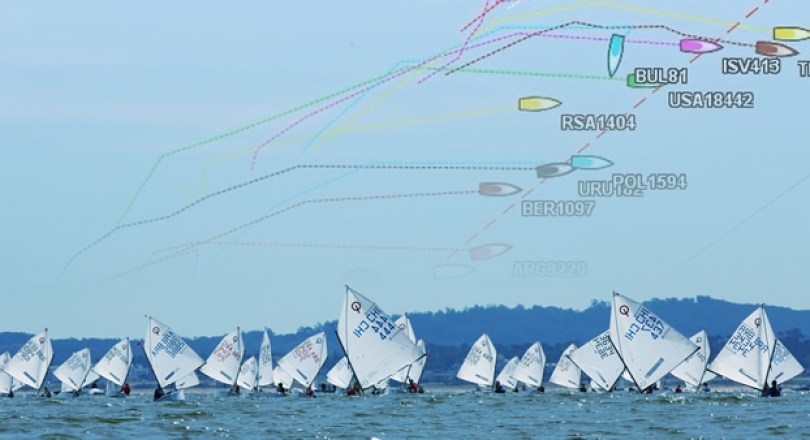
The initial view shows the last know position of all boats in the group. Click on “Start race” to show and track live positions. A race timer displays how long the race has been running for. Click on “Stop race” to end and save the race information to a local file.

When you stop the race two timestamped files are exported to your local desktop, a .kml file that can be used to view the tracks in Google Earth and a .geojson file which can be re-loaded up to the web page to replay the race using the “Choose file” button.

When a previously recorded race is loaded the following controls appear
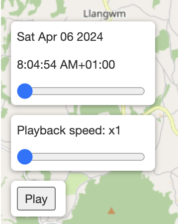
A slider to fast forward and back through the race and tracks. A Playback speed slider to set the speed of the playback and a Play/Stop button. Click the Play button to start replaying the race from the slider position. There is also a checkbox top right “GPS Tracks” to turn the tracks on and off.

Here is the PocketMariner YC page – currently both boats ashore.

https://boatbeaconapp.com/ais/race/PMYC

There is a recorded track you can download to your desktop and load up to try here ( N.B this was a cycle test track with one “test” boat ):-

PMYC_2024-04-06T07_04_39Z.geojson

We are looking for early adopters to gather feedback on what other features or improvement could be made to make the new Group Race feature useful. Please let us know if you try it and how you get on by emailing help@pocketmariner.com with the subject “Group races”.

We are also looking at the possibility of tracking  yachts and dinghies during club races using inexpensive small GPS trackers like the one below as an alternative to having the Boat Beacon app and are looking for a volunteer Yacht club to try this with.


The basic  idea is for the tracker and sim card to be cheap enough for a club to have enough of these devices to hand out to all race participants who don’t have Boat Beacon so they can follow the tracks of all participating yachts and dinghies on screen at the club house and review the race afterwards.

Our tests of the trackers show they can run for around 12 hours on one charge with position updates every 5s (12m accuracy at 5 Knots). We have sourced non-expiring IoT data sim cards which work on all networks with enough data pre-installed for 5 million fixes. We are now looking to try with real races and need a volunteer Yacht club based in the UK. We will supply the trackers for the trial at cost and the service for free. The raw cost per GPS tracker device including the lifetime sim card is around £75. If you are interested please contact help@pocketmariner.com with the subject “Race Trackers”.

Setting up club race courses with SeaNav

You can use SeaNav to enter and edit race courses, share these with others and navigate the course. Typically a club will have several race marker buoys and on any particular day set up a course using a subset of them plus possibly other fixed buoys in a particular order to best suit the conditions. This article shows you how easy and useful it is to do this using SeaNav in three easy steps:-

  • Ready. Enter all the race markers as POIs ( and use the SeaNav yellow flag race marker style). Typically you only need to do this once a year or less.
  • Set. Create a route from the ones you want to use as the course.
  • Go. Start racing the course.

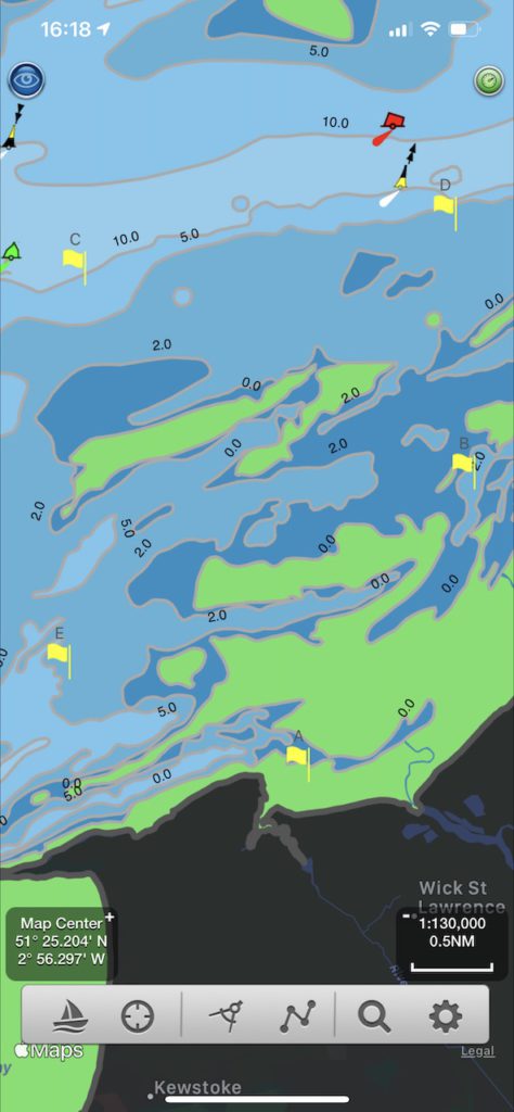
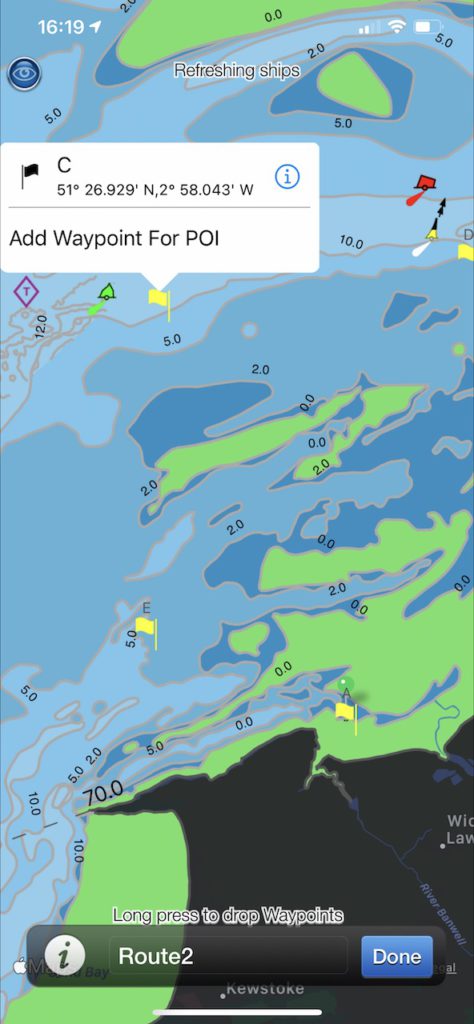
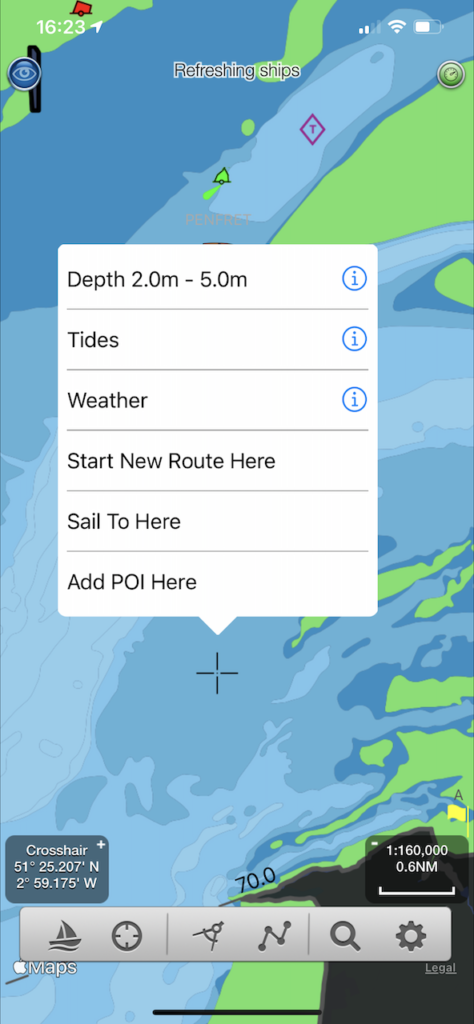
First step – Ready. Set up all the club’s race markers as POIs in SeaNav. For this example we will have 5 race marker buoys labelled A through E. Create each one by long pressing on the chart and tapping “Add POI here”

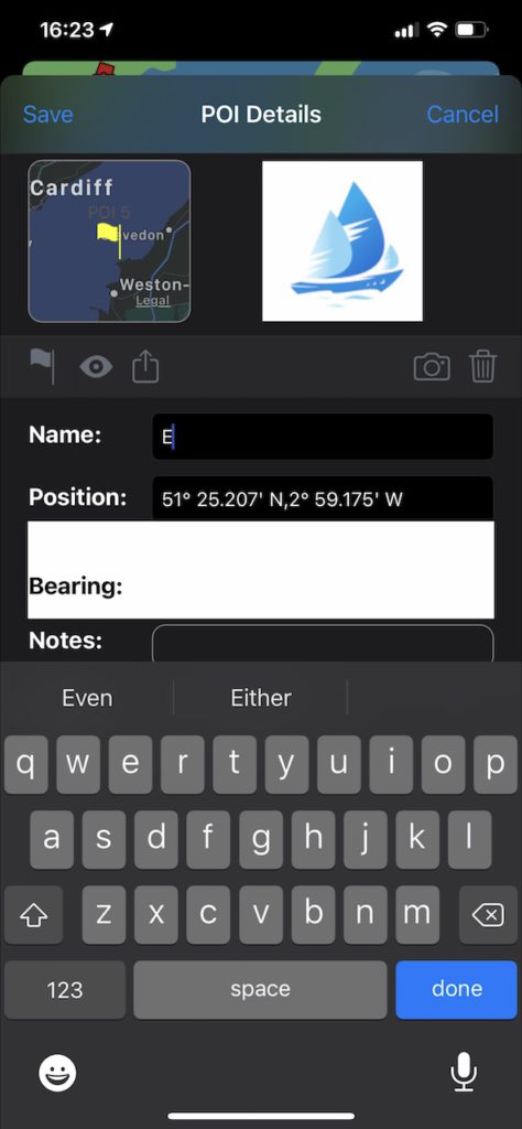
You can enter the buoy name in the edit screen that pops up and also choose the marker type (icon on left above the name field) e.g a yellow flag for a race marker). You can edit the Position Lat/Long if you want to make it more precise/accurate. You can also import the markers from kmz files.

After adding all the race markers, which you typically only need to do once a season, the next step is to set up the course for the day.

Second Step – Set: Enter the course as a New Route.

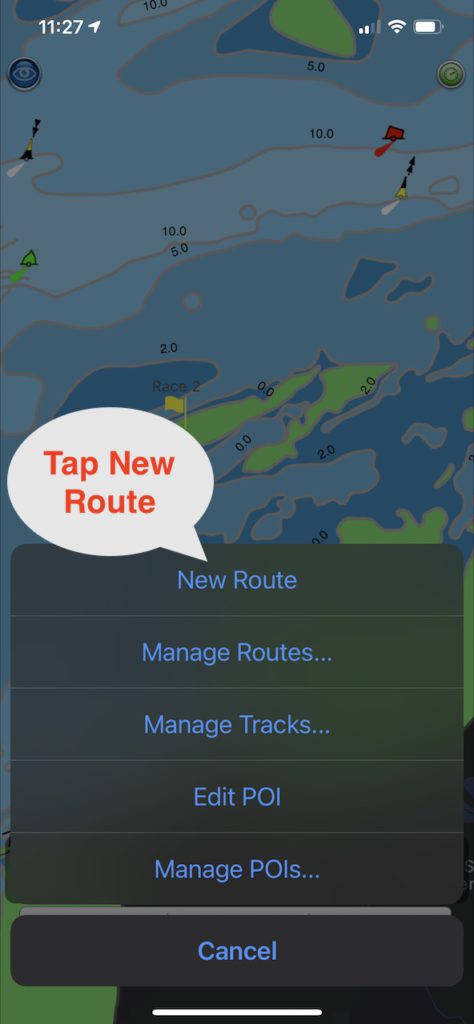
Tap the route/poi symbol on the bottom toolbar and then tap “New route”

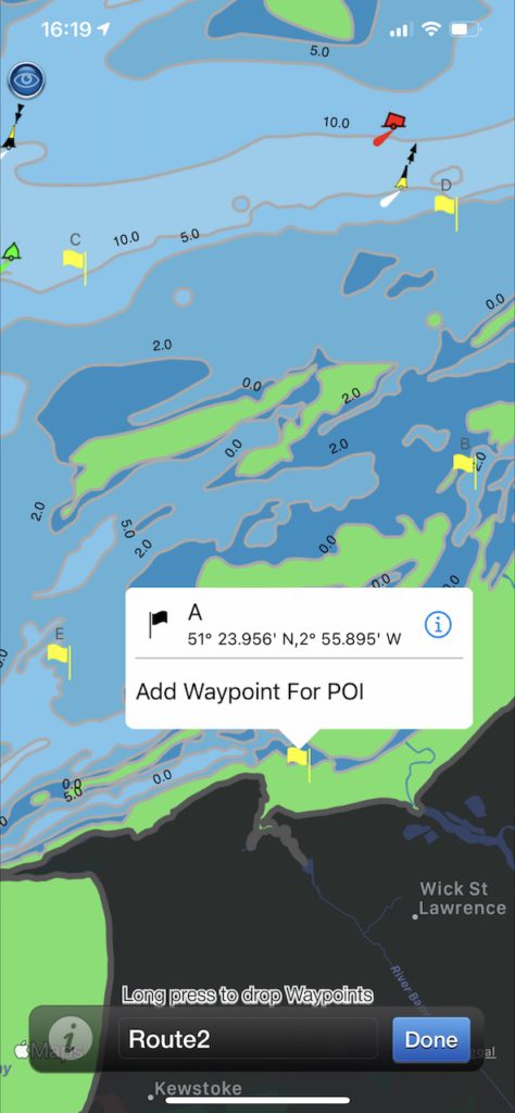
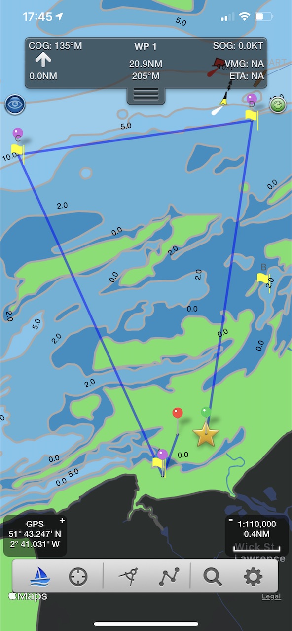
Enter a race start Waypoint or tap the POI race marker you want to be the start of the race and select “Add Waypoint for POI”. “A” in this example. Cycle through the rest of the markers in the order you want them adding them as waypoints . Here we are adding C and D and then ending back up at A.

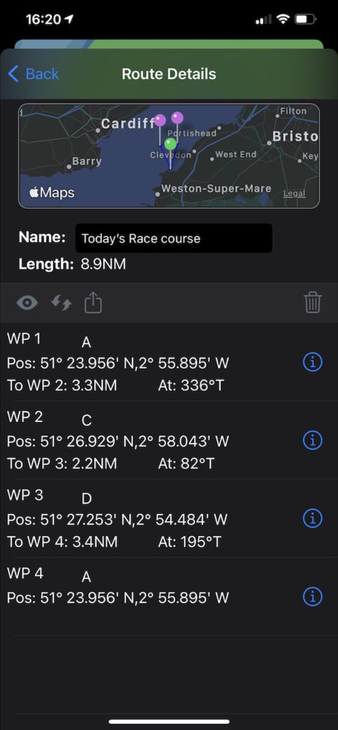
You can end back at the start or at a different marker. You can set a race start/end line using a start and end waypoint markers. Enter a name for the course/route now or later in Manage Routes. Tap Done when you have finished. You can now share the route with others via email or dropbox and also send it to your own email as a back up. In Route details you can see the overall route length and distances between waypoints.

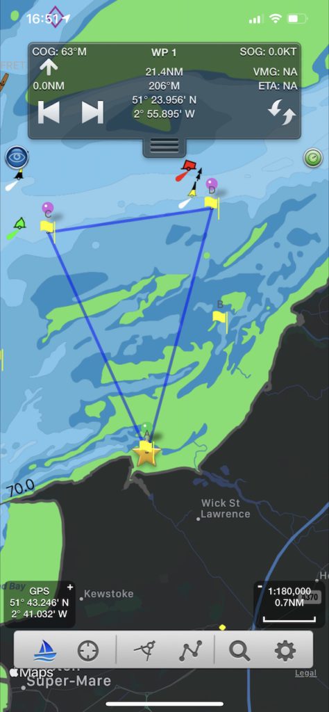
Final Step – Go: To start sailing the course just tap the Sailboat icon bottom left. It will mark the first course mark of the race with a star and show you the distance, bearing and ETA to it. When you reach it, SeaNav will automatically set the next race waypoint for you. You can manually choose the next waypoint in the route using the forward and back tab arrows in the navigation HUD at the top of the screen.

Get racing and good luck!

Melbourne to Port Fairy Ocean Yacht Race

Pocket Mariner are pleased to be sponsoring the  ORCV’s (The Ocean Racing Club of Victoria) Melbourne to Port Fairy Ocean Yacht Race this Easter. We are providing complimentary copies of our Boat Beacon app to all the entrants and race officials so they can track the fleet over the 135 mile race.

You can view and see the tracks for all the boats live here

http://boatbeaconapp.com/group/ORCV 2015 PORT FAIRY

We have also set up 5 Artificial Aids to Navigation for the start and finish of the race, marking Drapers Reef at the start line, ORCV Virtual Buoy, Point Lonsdale Light, Corsair Rock  and Nunn buoy at the finish line.

The AtoN’s are visible in Boat Beacon and our Boat Watch apps.

IMG_3740


You can read more about the AtoNs for the race on the ORCV web site here:-

http://www.orcv.org.au/index.php/port-fairy/4413-boat-beacon-ais-smartphone-tablet-app-aids-to-navigation