Independent trials of the Pocket Mariner AIS Dual channel receiver.

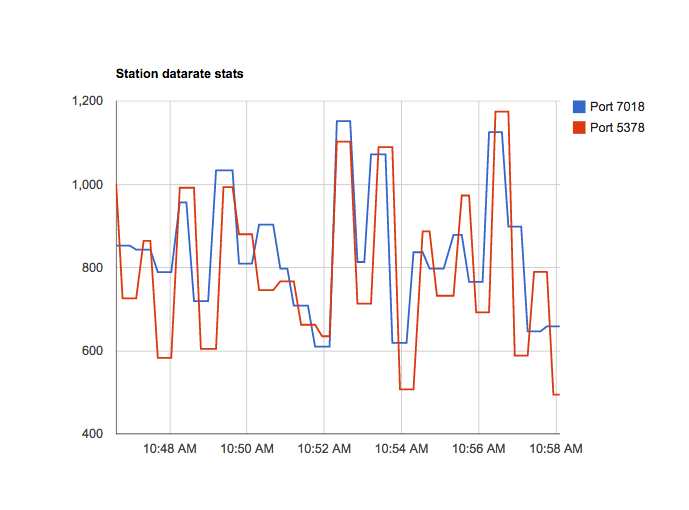
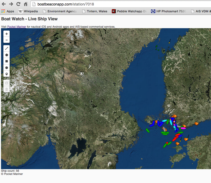
With the help of a ShipPlotter user in Finland we have been able to run side by side tests of our Pocket Mariner Dual Channel AIS receiver with a mainstream commercial brand AIS receiver costing over 3 times the price. We are very pleased with the results, with the Pocket Mariner Dual Channel AIS receiver achieving almost exactly the same coverage/range/data rate of the well known commercial brand. Here are some stats comparing our Pocket Mariner AIS receiver on port 7018 (blue) and the other on port 5378 (red ) and screenshots at the same time of the coverage from the same aerial in Helsinki.

Rate of data received (bits/s)

Screen Shot 2015-06-13 at 10.58.10

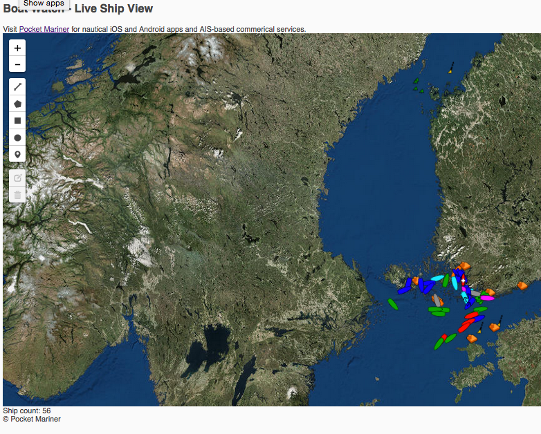
We also found that the coverage/range for both the commercial AIS receiver and ours was significantly improved using a relatively in-expensive AIS frequency (162MHz) tuned filter and pre-amp on the aerial feed. We used and would recommend the VHF Pre-amp from Spectrum Communications (formerly known as the Garex pre-amp). They start at around £15 for the pcb built one and around £50 for a boxed version. The ship ranges in the screenshots below is approximately 150km (100Miles).  The tropospheric conditions were good.

7018 Pocket Mariner Dual Channel AIS Receiver coverage snapshot


Screen Shot 2015-06-13 at 10.45.42


5378 Commercial AIS Receiver coverage snapshot

Screen Shot 2015-06-13 at 10.45.53

N.B. The buoys at the top of the screen (North) are over 350km away and most likely Synthetic Aids To Navigation being broadcast by a shore based station nearer our aerial.

If you are interested in having a Pocket Mariner Dual Channel AIS receiver please get in touch with us at . support@pocketmariner.com


Pocket Mariner live AIS Coverage

Our ship tracking network uses a global network of shore and ship-based radio stations, which receive signals from the AIS system that ships use to broadcast their positions as they travel. Our receiver stations share the ship positions with our cloud-based data server, which pushes them onwards and out to our apps and web services.

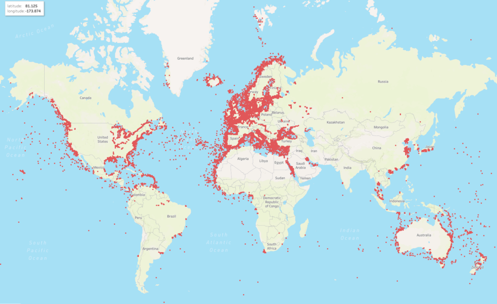
We are continuously working on increasing the coverage of our real-time AIS receiver station network. During the last three months we have added more than 100 new AIS stations across 5 continents bringing our live ship coverage to over 40,000 ships. We have supplied the AIS receiver for free for many of these sites. New volunteers are always welcome to join our AIS Network.

Here is a  list of the most recent stations we have set up  and a snapshot of our global coverage Q2 2019

America

Hudson Bay, NJ
Sakonnet River in Rhode Island
St Lawrence Seaway
British Columbia
Miami, Florida, US (2 new stations)
Antioch, CA.
Stockton,CA
St Bartholomew (Caribbean)
Dominian Republic.
Buenaventura, Colombia.
Lake Erie
Several stations in Uruguay
Several stations in Mexico

Europe

The whole of Norway
The whole of Denmark
The whole of Finland
Scicily, Italy
Turku, Finland
Maasbracht, Netherlands
Ijsselmeer, Nethrlands
Ust-Luga, Russia
St Petersburgh, Russia
Edinburgh, Scotland
Over 30 new stations in and around Sweden.
Eastbourne, UK
Scilly Isles, UK
Isle of Man, UK
Lowestoft, UK
Alicante, SP
Faro, Portugal

Africa

Port Harcourt, Nigeria.
Canary Islands
Dakar, Senegal

Middle East

Kuwait
Dubai

Australasia

Perth, Adelaide, Darwin, Australia
Nagoya, Osaka, Inland Seas, Japan
Singapore
Indonesia
Ho Chi Min City, Vitenam
Sihanoukville, Cambodia.

If you are interested in adding coverage for your area, please read our Cover Your Area information – we can often provide the equipment free of charge.

Row around Singapore Island (RASI), Mission to Seafarers and Boat Beacon AIS tracking

Pocket Mariner are very pleased to be sponsoring the  Row around Singapore Island  in aid of the Mission to Seafarers .

A group of 40 enthusiasts from the maritime and insurance community in Singapore have come together, to undertake a 24 hour endurance sea challenge, all in aid of the global maritime welfare charity, The Mission to Seafarers.

Mission Row Around Singapore Island (RASI), will see two teams in ocean-going rowing boats attempt the 140km journey, taking on the seas and shipping lanes (not to mention two live military firing ranges) to complete a non-stop circumnavigation of the island of Singapore. The event itself will be held during the 50th anniversary year of Singapore’s independence and will also coincide with Singapore Maritime Week on the 22nd / 23rd April, 2015.

Pocket Mariner have provided their Boat Beacon app to both teams so they can share their position and speed during the event and everyone will be able to follow their progress on our live group tracking web view service.

http://boatbeaconapp.com/portwatch/missionrasi.html. If you would like to add the view to your own web page you can use the following iFrame:-

<iframe src=”http://boatbeaconapp.com/portwatch/groupwatch.php?group=MISSIONRASI&drawtools=1&embed=1&groupgetotherships=0″></iframe>


If you are organising an event or a race and are interested in having live tracking available please contact us :- support@pocketmariner.com

Watermark Round Britain Voyage Summer 2015 and Boat Beacon AIS

Watermark is a Beneteau First 33.7 Cruiser/ Racer  currently on a round Britain voyage.  She is using Boat Beacon to share her position over internet AIS with friends and family on Boat Watch and our new live iframe “embed” web page that lets you add a map showing your boat’s location to other web pages (e.g. a blog). Use the following as a template, you can set the width and height to fit your page

“<iframe style=”border:none;height:600px;width:1800px;” src=”http://boatbeaconapp.com/see/MMSI?embed=1″></iframe>”

Where MMSI is your boat’s MMSI number (as set in Boat Beacon). If you don’t have an MMSI, we can provide you with an internet AIS one, or you can use your Boat Beacon identity instead starting with BB (see the bottom of My Boat Details in Boat Beacon to find your Boat Beacon id). If you don’t have  blog or web site you can also give out a web link to your web page on our site – e.g. http://boatbeaconapp.com/see/MMSI

We wish Malcolm and Watermark a safe and very enjoyable circumnavigation and look forward to following their progress. Here is his current postion :-


Apple Watch – Pocket Mariner apps

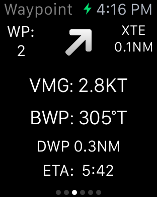
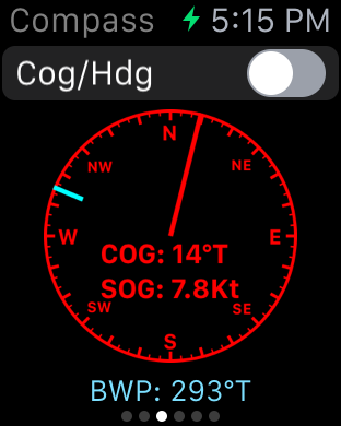
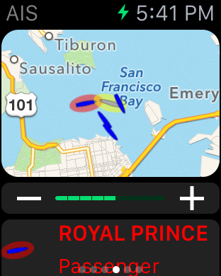
We have been working hard to ensure Apple Watch versions of all our marine apps are ready for you as soon as you get your new Apple Watch. Boat Beacon, our signature app, now gives you collision alerts directly on your wrist with CPA time and distance information and a map overview. Check your next waypoint wherever you are on your boat with a compass view, cross track error (XTE), distance and ETA on our SeaNav watch app.  Spot nearby boats, track your ferry or a boat of interest and get arrival and departure alerts with our Boat Watch app on Apple Watch.


PocketMariner_SeaNav_on_Apple_Watch_aPanbo-thumb-465xauto-11115

SeaNav and Boat Beacon Navigation view


iOS Simulator Screen Shot - Apple Watch 16 Mar 2015 16.15.02


SeaNav Waypoint face.


iOS Simulator Screen Shot - Apple Watch 16 Mar 2015 16.16.59


Boat Beacon and SeaNav Compass view


iOS Simulator Screen Shot - Apple Watch 16 Mar 2015 17.15.53


Boat Watch, Boat Beacon and SeaNav map AIS view

iOS Simulator Screen Shot - Apple Watch 16 Mar 2015 17.41.07


As ever – ship photos to help you identify it.

iOS Simulator Screen Shot - Apple Watch 16 Mar 2015 17.49.20


And the great news ….. the watch apps are all free upgrades to our existing apps 🙂

Melbourne to Port Fairy Ocean Yacht Race

Pocket Mariner are pleased to be sponsoring the  ORCV’s (The Ocean Racing Club of Victoria) Melbourne to Port Fairy Ocean Yacht Race this Easter. We are providing complimentary copies of our Boat Beacon app to all the entrants and race officials so they can track the fleet over the 135 mile race.

You can view and see the tracks for all the boats live here

http://boatbeaconapp.com/group/ORCV 2015 PORT FAIRY

We have also set up 5 Artificial Aids to Navigation for the start and finish of the race, marking Drapers Reef at the start line, ORCV Virtual Buoy, Point Lonsdale Light, Corsair Rock  and Nunn buoy at the finish line.

The AtoN’s are visible in Boat Beacon and our Boat Watch apps.

IMG_3740


You can read more about the AtoNs for the race on the ORCV web site here:-

http://www.orcv.org.au/index.php/port-fairy/4413-boat-beacon-ais-smartphone-tablet-app-aids-to-navigation

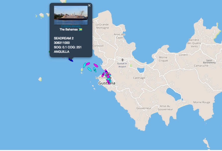
New AIS Aerial in the Caribbean on St Barts

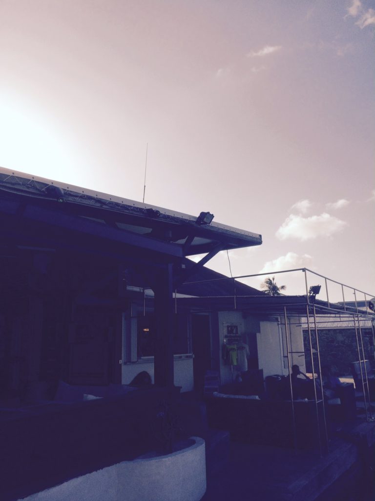
Our latest AIS aerial  on St Barthelemy in the Caribbean has just gone live. If only I could go out and test it! Thanks to Emmanuel at Jicky Marine Service

http://boatbeaconapp.com/station/7017

Screen Shot 2015-03-25 at 16.07.12


Our AIS aerial on top of Jicky Marine Service’s office.

FullSizeRender (3)


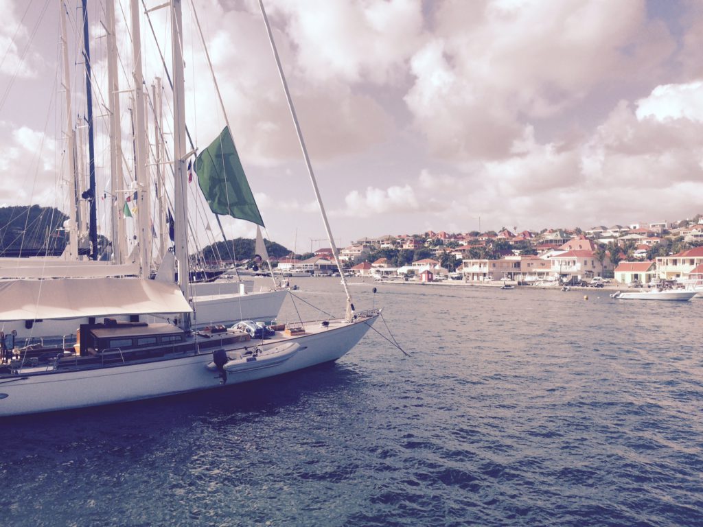
Jicky Marine’s office from the other side of the Harbour


FullSizeRender (4)


Plan of Gustavia  looking from the land side out to sea (North is bottom right) showing the office location.


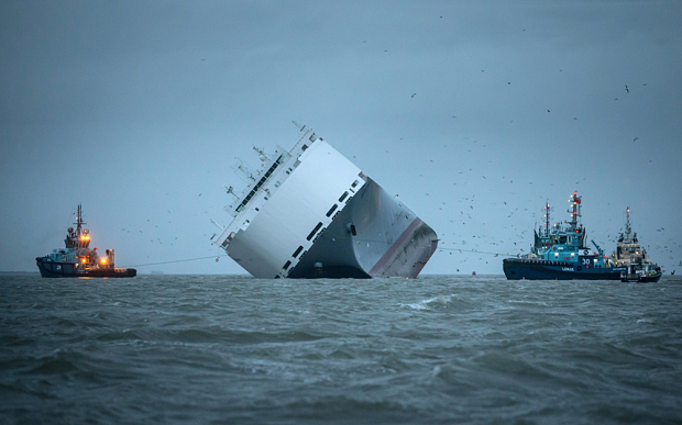
Hoegh Osaka – replay of grounding in 2 and 3D

osaka-ship_3157884b


We used our AIS Fleetwatch service  to replay the final moments before the Hoegh Osaka was deliberately grounded on Bramble Bank in Southampton. You can watch the speeded up replay on 2D and 3D here http://youtu.be/5fW_LRDWUPo . Interestingly our replay correctly shows the ship heading onto the bank in a Northerly direction before she grounds. Other replays incorrectly show her moving sideways onto the bank. It may be that the gyros failed on the ship just before she started listing badly resulting in the list and an incorrect ship’s heading being sent.


New AIS Aerial at Davidstow Airfield, Cornwall

As part of the ongoing work to improve our global AIS coverage we have installed a new AIS aerial to provide better real time coverage for the seas around Cornwall in the UK.  There is a disused airfield at Davidstow. It was Coastal Command’s highest airfield in the UK at 300m (1000′) above sea level; a perfect place to get a long range view of the surrounding sea,  to the North, West and South of Cornwall.  We used a Digital Yacht AIS Net base station for the AIS receiver with a Shakespeare 6db AIS tuned aerial. There is no internet connection at the museum so we used a Huawei E3551 3G dongle and the excellent EE 3/4G data service to backhaul the AIS data to our servers.  You can check the live coverage from the new aerial here:-  http://boatbeaconapp.com/station/5353

Here is my son installing the aerial on the tower at the airfield.

image1


The DY AIS receiver hooked up at the base of the aerial.


image2


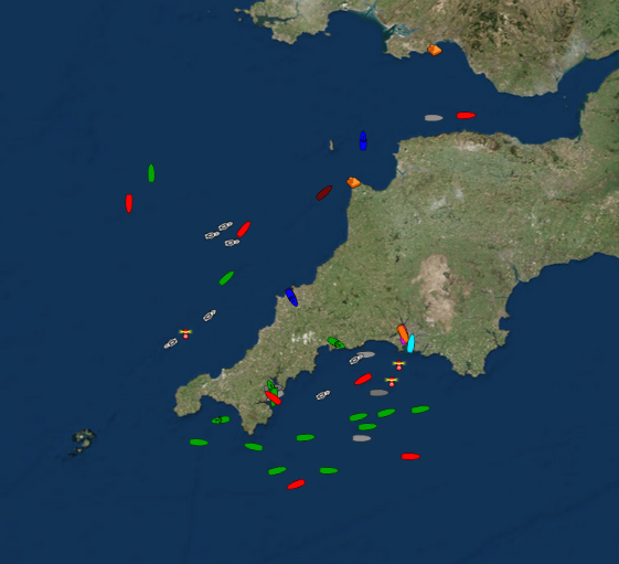
and live ships –  10,000 square miles of coverage including two major ports at Falmouth and Plymouth 🙂

Screen Shot 2014-10-07 at 16.56.24

Many thanks to Steve at Davidstow Airfield and Cornwall at War Museum who is kindly letting us use his tower to mount the aerial on  (giving us another 12m (40′) of elevation 🙂 . The museum is very well worth visiting if you are in the area and even if you are not.

Portsmouth Pilots choose Pocket Mariner’s AIS Live and Replay services

Pocket Mariner’s real time AIS data service, FleetWatch,  has been selected by the Pilots at Portsmouth International Port  to use with their Portable Pilot Units (PPUs) running SevenCs ORCA Pilot G2 solution.  The Pilots use Pocket Mariner’s real time enhanced AIS data feed to display live ship positions and courses on and around their client’s ship as they travel out to pilot it. The enhanced feed ensures all the vessel information including name (so you can call the ship via VHF radio) and dimensions is instantly available as soon as the PPU connects unlike VHF AIS where it can take several minutes to acquire the extra data. Ben McInnes, Harbour Master and Portsmouth Pilot said: “The real time internet AIS feed allows us to “virtually board” the ship and assess the situation before we even get there.” Portsmouth have also selected Pocket Mariner’s AIS Replay service to review and playback incidents and for training purposes.
Steve Bennett, Pocket Mariner’s CEO commented: “This is a great endorsement of Pocket Mariner’s “real time” AIS data service that we use to power our own Marine Navigation Apps and we look forward to them using our additional AIS data services including geo-fence event triggering and instant history replay capabilities “.
Please contact us at business@pocketmariner.com to learn more about how our FleetWatch and PortWatch service can help you.
Here is a screenshot of live ship traffic around Portsmouth using the Pocket Mariner AIS service and SeaNav charting app:-
IMG_0284
To learn more about Pocket Mariner’s AIS data services, SDK and API’s please email us at business@pocketmariner.com