Pocket Mariner live AIS Coverage

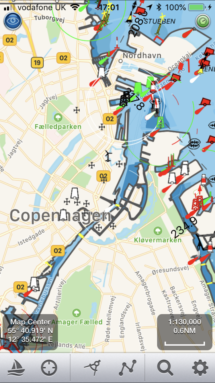
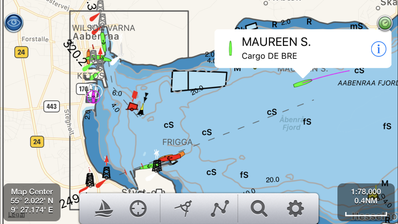
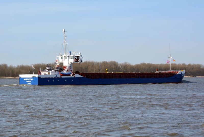
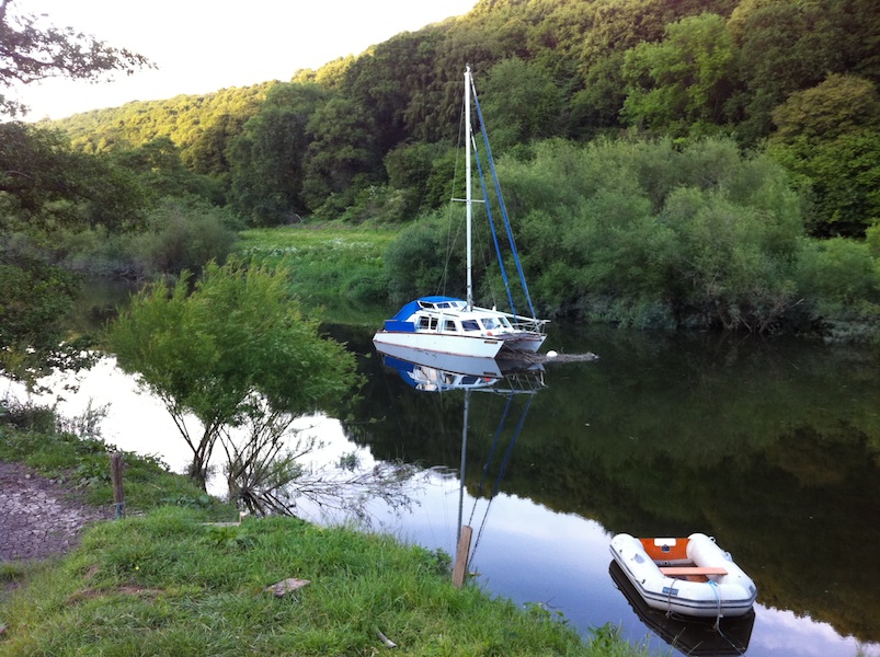
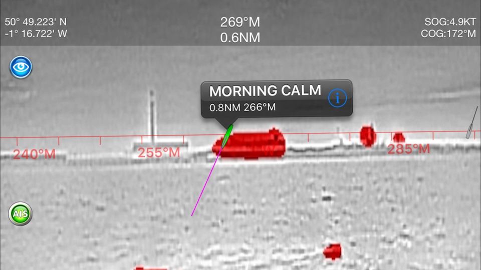
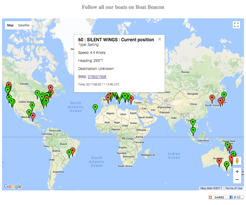
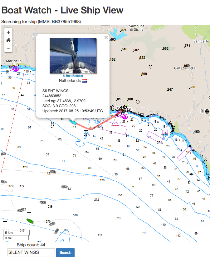
Our ship tracking network uses a global network of shore and ship-based radio stations, which receive signals from the AIS system that ships use to broadcast their positions as they travel. Our receiver stations share the ship positions with our cloud-based data server, which pushes them onwards and out to our apps and web services.

We are continuously working on increasing the coverage of our real-time AIS receiver station network. During the last three months we have added more than 100 new AIS stations across 5 continents bringing our live ship coverage to over 80,000 ships. We have supplied the AIS receiver for free for many of these sites. New volunteers are always welcome to join our AIS Network.

Here is a  list of the most recent stations we have set up  and a snapshot of our global coverage Q1 2022
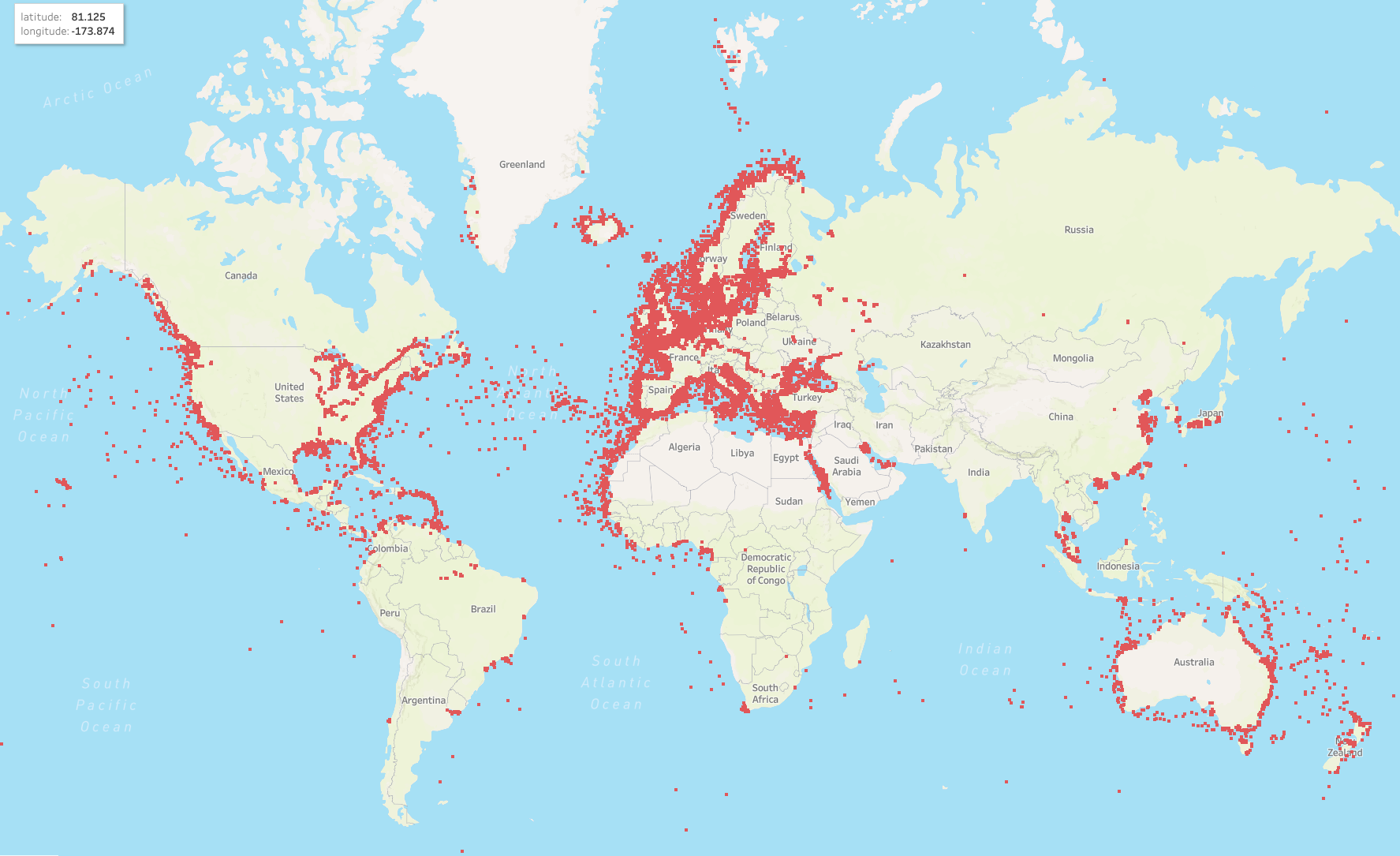
America

Hudson Bay, NJ
Sakonnet River in Rhode Island
St Lawrence Seaway
British Columbia
Miami, Florida, US (2 new stations)
Antioch, CA.
Stockton,CA
St Bartholomew (Caribbean)
Dominian Republic.
Buenaventura, Colombia.
Lake Erie
Several stations in Uruguay
Several stations in Mexico

Europe

The whole of Norway
The whole of Denmark
The whole of Finland
Scicily, Italy
Turku, Finland
Maasbracht, Netherlands
Ijsselmeer, Nethrlands
Ust-Luga, Russia
St Petersburgh, Russia
Edinburgh, Scotland
Over 30 new stations in and around Sweden.
Eastbourne, UK
Scilly Isles, UK
Isle of Man, UK
Lowestoft, UK
Alicante, SP
Faro, Portugal

Africa

Port Harcourt, Nigeria.
Canary Islands
Dakar, Senegal

Middle East

Kuwait
Dubai

Australasia

Perth, Adelaide, Darwin, Australia
Nagoya, Osaka, Inland Seas, Japan
Singapore
Indonesia
Ho Chi Min City, Vitenam
Sihanoukville, Cambodia.

If you are interested in adding coverage for your area, please read our Cover Your Area information – we can often provide the equipment free of charge.

School Amateur Radio clubs building AIS receivers

The School Amateur Radio Club Network (www.sarcnet.org) got in contact with us to let us know about their work promoting radio clubs in Schools. They are a neat way to get in an extra shot of Science, Technology, Engineering and Mathematics (STEM) while exercising on-air conversational skills and tuning up enquiring minds. Amongst the many very interesting projects they help schools with ranging from high Altitude Balloon Telemetry to Robotics  one is an AIS receiver which shares its data with our network and others.  They provide details of the free DIY AIS Receiver project based on a Raspberry Pi Zero and an RTL-SDR dongle at https://www.sarcnet.org/ais-receiver.html and they say many AIS enthusiasts around the world have built their project and share their data with us.

Having taken a look at their excellent tutorial we hope schools and science teachers will pick up on it. We have also suggested they might want to include an easier aerial to build based on our experience with the simple dipole aerial which we made for the cost of a length of coax cable and got over 30NM range with – see https://pocketmariner.com/simple-3db-dipole-vhf-ais-marine-aerial-co-ax-cable/

Relocating our Portsmouth Harbour AIS aerial

Relocating our Portsmouth Harbour AIS aerial

For several years we have been successfully running one of our network of AIS stations in the house of Digital Yacht’s CTO, Paul Sumpner, up on Portsdown Hill overlooking Portsmouth Harbour. All of the AIS equipped vessels operating out of Portsmouth and the central Solent were picked up and transmitted over a 4G data connection to our AIS servers. The aerial position was especially important for picking up vessels in the Northern reaches of Portsmouth Harbour.

Many users of our Boat Beacon and SeaNav apps and Portsmouth International Port benefit from this data. Paul has decided to move house and area and the pressure was on to find an alternative location in time. Fortunately, following Paul’s suggestion the wonderful people at WicorMarine volunteered to become the new custodians and yesterday we went down to help them install the system.

WicorMarine Yacht Haven is located at the top of Portsmouth Harbour, with clear line of sight across the whole harbour and we hoped that the AIS reception would be as good as before.

Between the rain showers, the WicorMarine team mounted the VHF antenna on top of their weather sensor mast, while we powered up the Digital Yacht AISNet and 4GConnect router and tested that the AIS data was being received and forwarded to the internet web server.

The results were much better than we had expected and if anything we were actually getting better all round range, than previously. As you can see from the image below, 175 targets all the way up Southampton water, as far West as Lymington and way out in to the Channel beyond Nab Tower.

Everyone at Pocket Mariner, Digital Yacht and WicorMarine are very pleased with the new installation and we hope it will continue to give perfect service for many years to come.

A big thank you to Scott Waddington and his team at WicorMarine for the use of their facilities and the professional and efficient manner in which they handled this new project.

Entering routes and waypoints with SeaNav on a Mac

Here is how to enter routes and waypoints in SeaNav Mac
Left mouse click on the chart and select “Start new route here”
Screenshot 2019-05-21 at 12.48.31.png
A green pin will be placed on the map and the Navigation panel will display on the left with the first waypoint information.
To add the next waypoint move to another point and left mouse click and select “Add waypoint here”.

A red pin will appear with a blue line (route) from the first pin.
Screenshot 2019-05-21 at 12.48.59.png
You can add as many waypoints as you require and drag and drop the waypoint markers using a long mouse select on them.

Tap the i button on a Waypoint to give it a name ( optional) and view the full lat and long position ( including when you drag and drop it) so you can set its location precisely.

Screenshot 2019-05-21 at 12.53.03.png
Click on Done when finished and you can then sail the route at any time by pressing Sail. You can also select a previously saved route, Sail it , edit it or export it.
You can add a set of existing waypoints from a spreadsheet following this blog article:-
Here’s our guide on iPhone which also has some relevance to Mac. You can also export/import routes between the iOS SeaNav and Mac SeaNav app and also view them in Google Earth.
You can view the routes at any time by tapping the Navigation tab – there is a Demo route in the Solent included with the app that you can use to play with (tap the i button to view the route details and select Edit Route) :-
Screenshot 2019-05-21 at 12.58.45.png

New Zealand and Finland Marine Charts for SeaNav

SeaNav now has seamless official raster (RNC) charts available for download for the whole of New Zealand and Finland. You can use all SeaNav’s route planning, POI and live navigation tools and display on top of the charts like you can with the existing vector charts.

Charts are automatically installed and saved as you browse and zoom in on SeaNav and you can also download all the charts in a map region for offline use ( no internet connection) in a single go.

Zoom right in to get fantastic detail on the charts. Here’s the marina in Auckland with live AIS ship positions overlaid:-

Here is Finland showing the chart coverage (outlined in red):-

and here is Helsinki zoomed in about half way:-

And zoomed close in at the beautiful Aaland islands between Finland and Sweden

You can find the new raster charts listed under SeaNav/Settings/SeaNav Chart Store in the new “Raster section at the bottom”.  A yearly subscription also provides ongoing chart updates from the Finnish and New Zealand Hydrographic offices. Get SeaNav for free from the app store and download  the new chart IAPs now:-https://itunes.apple.com/app/seanav/id857841271

Danish Vector Marine charts for SeaNav

Danish charts are now available in SeaNav. The vector marine charts are licensed and derived from the official Danish Hydrographic Office data. These cover the whole of the European Danish waters. Please see the coverage map below.

Coverage Map for Danish charts:

Here is a close up on the iPhone showing the approach to Copenhagen. Being  vector charts, all chart objects are tappable to give more information. This includes names and types as well as distance and bearing from your position. Sectored lights also show the colours, range and sector angle when tapped.

SeaNav also has complete live Ship (AIS) coverage for the whole of Denmark. Here is an example in the Aabenraa Fjord showing the Maureen S. just departed on her way to Germany.

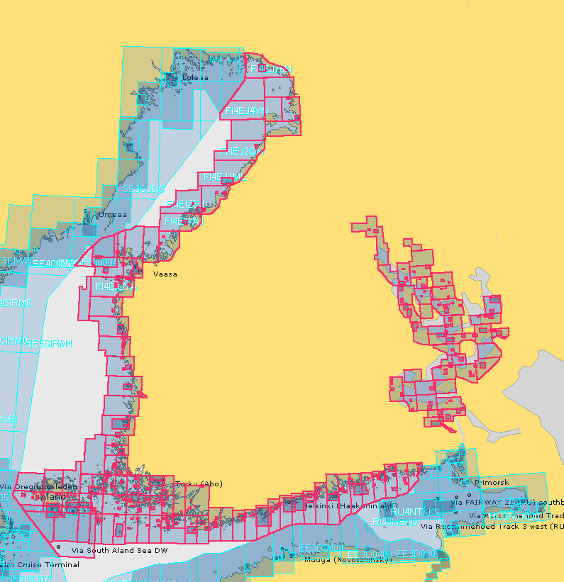
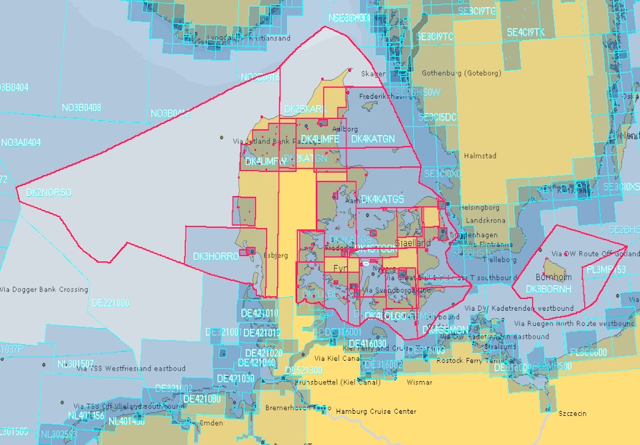
SeaNav now has UK, IE, NL, BE, FR, DE, ES, US and CA charts available with complete coverage across the English Channel  and we now have continuous coverage from Nantes in France through Belgium and the Netherlands, across Denmark and Germany including the German inland waterways.  Current European chart coverage is outlined in red below.
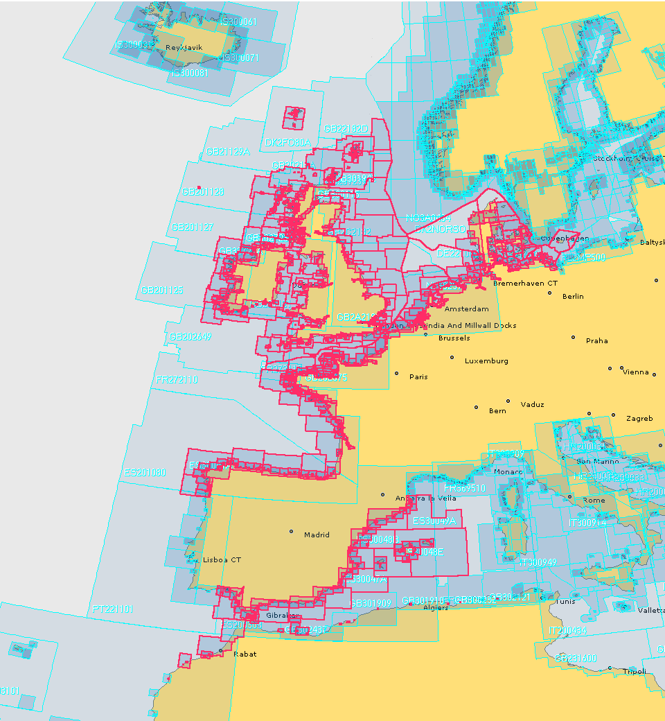
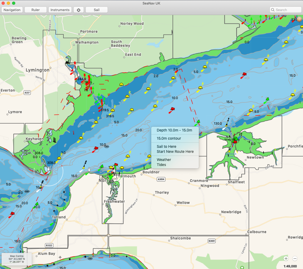
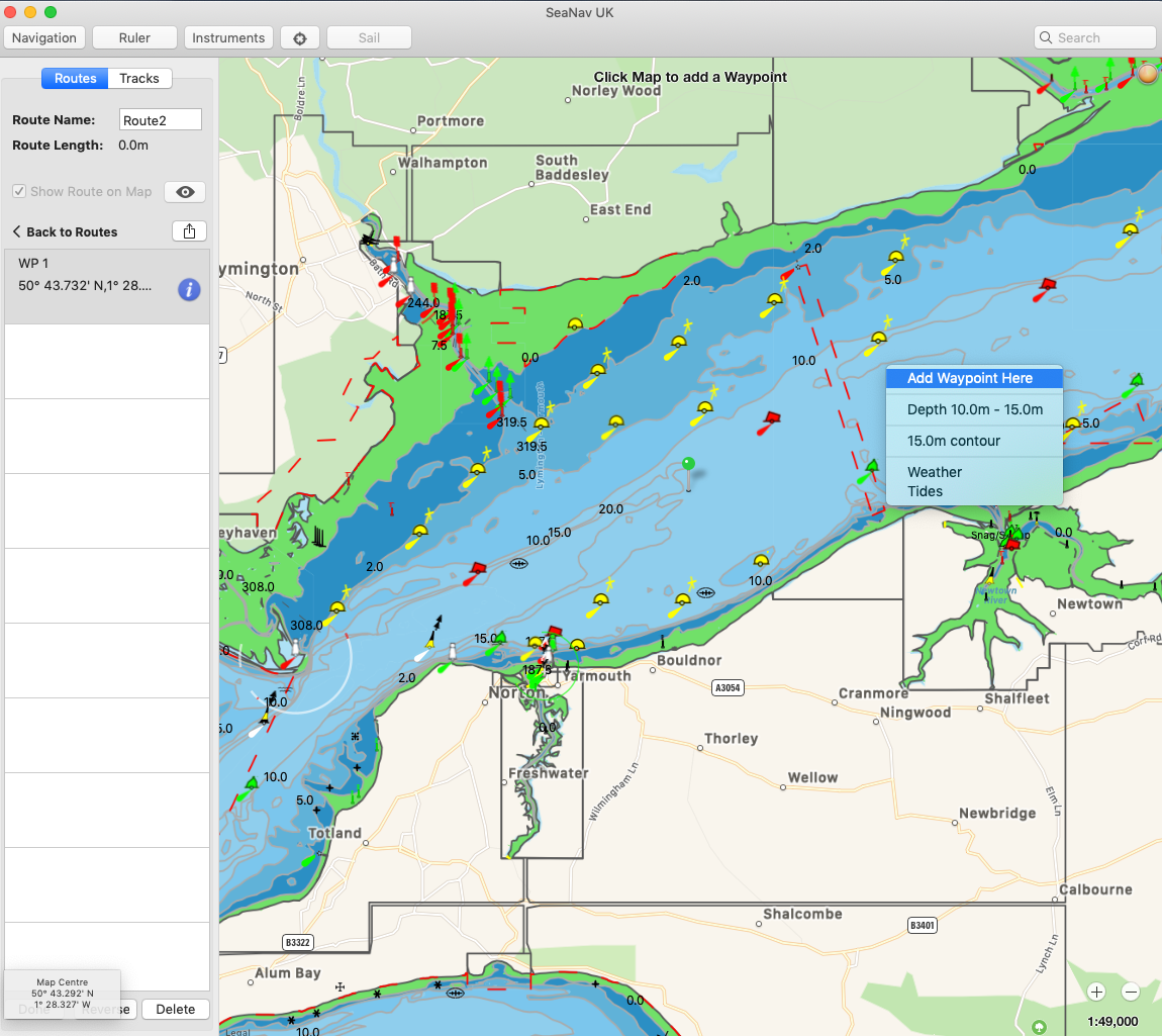
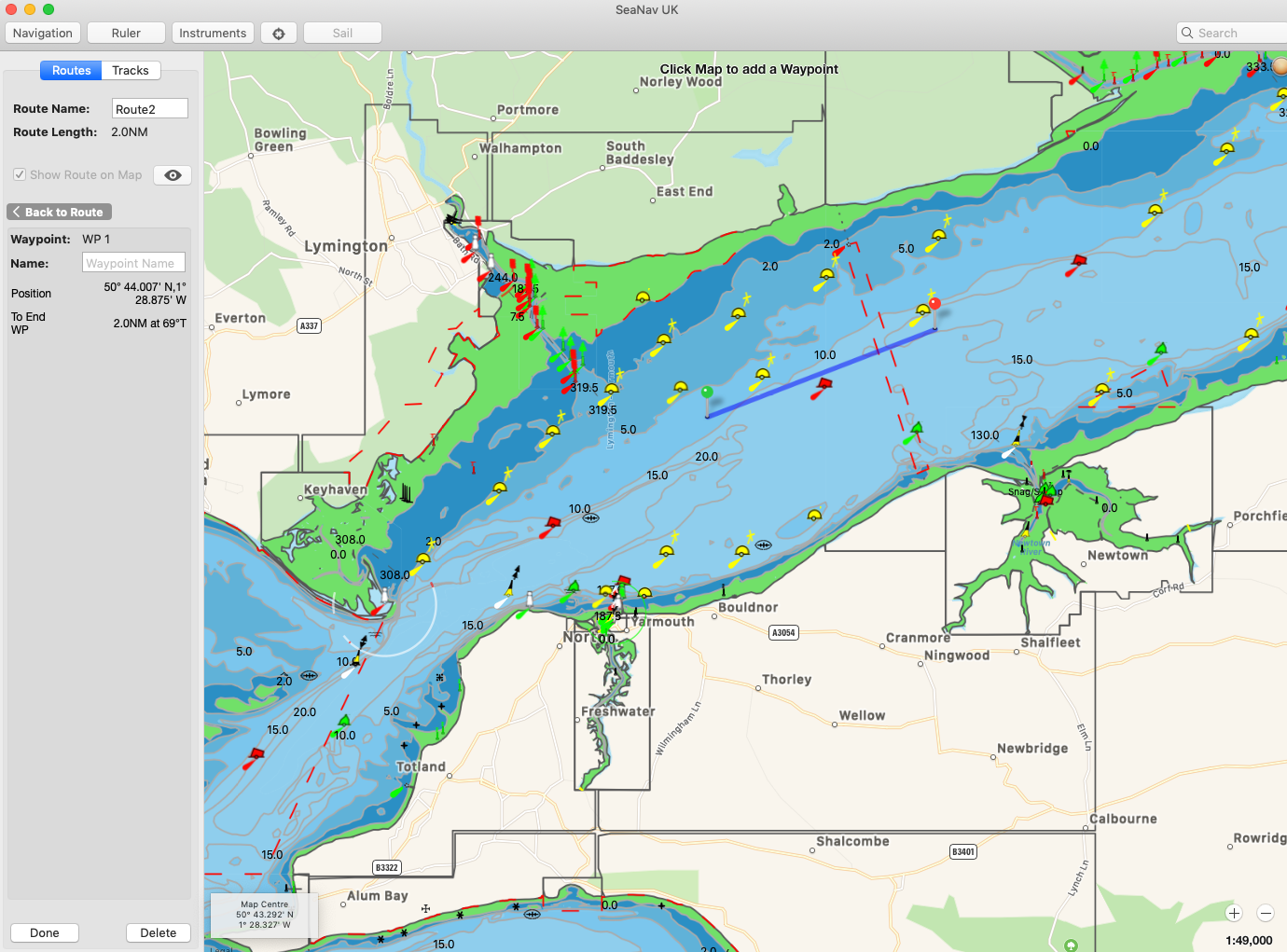
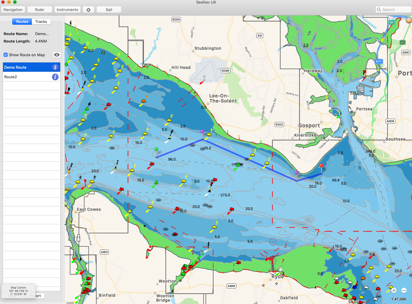
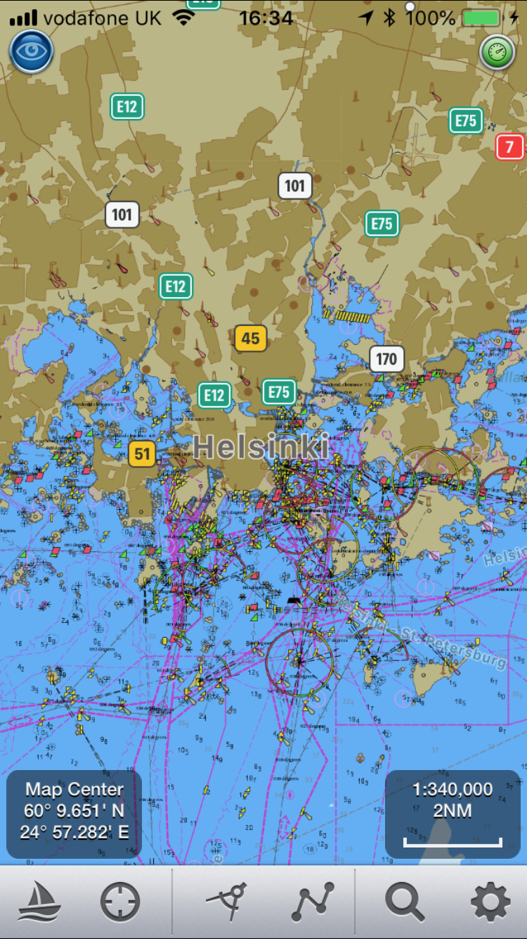
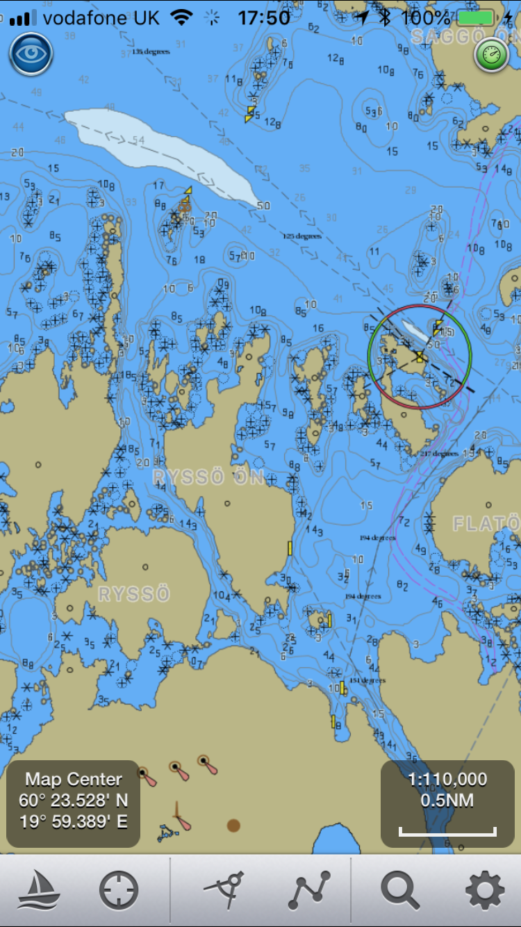
Norwegian charts are also available for free in SeaNav’s sister app, NaviPlotter by Nautisk (same app as SeaNav but with different branding and additional Norwegian charts from the Norwegian HO).

The Danish charts and others can be obtained via a simple In App Purchase (IAP ) in SeaNav and SeaNav UK. All SeaNav charts are regularly updated while you have a valid chart subscription in place. You can read more about SeaNav and how to download our free version here –  SeaNav

Charter a yacht with Click&Boat – the Airbnb for boats

When I am travelling for business to places near the sea I always want to be able to charter a yacht to stay on instead of having to search for a hotel – I  just prefer the peace that this offers. I was actually able to manage it once while visiting Barcelona for a very large conference. You’d typically think that this would be just as, or if not more expensive but I was able to save a fortune compared to the cost of the regular hotels in the city. On top of this I  had a fantastic  sea view. Truthfully, at the time it was quite difficult for me to find and arrange. Although not any longer. I have discovered this great new website for yacht charter , Click&Boat.

The company is the boating equivalent of Airbnb. Boat owners create listing for their boats depending on their availability, they choose the price, dates and can offer charters with or without a skipper. Users simply enter in your search requirements, browse the range of boats available and take their pick. Once they have requested the boat they would like they are able to talk directly to the boat owner to make the final arrangements.

So in my case; I needed to stay in Southampton for a Boat Show. The exhibition hotel was over £300 a night and fully booked so instead I found a yacht to charter on  Click&Boat within walking distance of the show and for less than half of that price.

I am also thinking of putting my catamaran Sarita on the Click&Boat website – fancy a stay on the beautiful river Wye with power and water to hand?

Sarita alfoat again.

Click&Boat have more than 20,000 yachts listed on their websites and over 40,000 customer reviews. They are the European authority on peer to peer yacht charter and offer you a secure service.

Go take a look.

Augmented Reality with FLIRONE

Augmented Reality with FLIR ONE

MORNING_CALM_BB_AR_FLIR_IOSPocket Mariner collaborated with Practical Boat Owner to successfully complete a demanding night time sea trial of our popular marine navigation apps, SeaNav HD and Boat Beacon with the  FLIR ONE Thermal Imager for iOS; a new, low cost , infra-red thermal imaging camera for the iPhone.  The FLIR ONE makes thermal imaging affordable and accessible to a much wider audience at a fraction of the cost of the higher end marine IR imaging devices. Pocket Mariner have ingeniously integrated the live thermal image with their widely acclaimed iOS Augmented Reality mode providing identification, distance and bearing of the ships and Aids To Navigation in view at night and in fog.  We wanted to see how well and how far off we could spot ships via their infra-red signature and if the FLIR ONE could help with searching for a Man Overboard (MOB).

Practical Boat Owner, the UK’s leading boating magazine, bravely deployed their editors, David Pugh and Ben Meakin, together with Ben’s Impala 28 yacht , “Polly” and intrepid “Woman Overboard” volunteer, Laura, along with Pocket Mariner’s CEO, Steve, on a pitch black night in Southampton water.

Here’s what we saw.

Continue reading “Augmented Reality with FLIRONE”

Boat Beacon transmitting live internet AIS for over 200 boats world wide

Boat Beacon allows folks to share their position and course in real time with other users and folks back home using just their iOS or Android device. Their position is also visible on other internet based AIS tracking services such as SeaNav and our free Boat Watch app and the very popular MarineTraffic service. Use your VHF assigned MMSI number or request a free internet AIS MMSI through us to be visible on the public AIS internet services. A lot of the CoastGuards use MarineTraffic so you can be visible on their systems too. For instance Boat Beacon is used by the Australian Voluntary Coast Guard for automatic tracking.

With cellular data  coverage around most of the popular coasts extending out to 12NM or more the range is excellent. Here are the Boat Beacon boats out around the world right now:-

Clicking on an individual boat shows more details and you can also use view their track (layer control top right).

All the Boat Beacon boats currently transmitting their position can be seen here:- http://boatbeaconapp.com/kml/findlive.php

Our Boat Beacon app also tracks all the boats and ships around you in real time via internet AIS and uniquely provides proven constant collision avoidance detection, even in the background. Other popular features in Boat Beacon are our AIS augmented reality view, anchor alarm, theft alarm and MOB features. Boat Beacon is available now in the App Store for iPhone and iPad and in the Google Play Store for Android phones and tablets.

SeaNav Favourite Places – Share POIs and Routes

We have received a lot of requests from our SeaNav users wanting to mark a favourite fishing or diving spot, beautiful anchorage etc. You can now do this in SeaNav with the new Favourite Places feature.  Add custom markers to your charts for places you want to remember, share with friends or even better share with the rest of the SeaNav community. There are several types now available:-

  • fishing spots
  • diving locations
  • favourite anchorage spots
  • hazards
  • race markers for club racing
  •  information/reminder
  • bridges

Set up a series of race marks or route for your local club and share with all. Update them in an instant if there is a change in the wind. Add a reminder for which VHF channel to call a marina or VTS. Use your local knowledge to mark a hazard to warn other users. Let people know about a service or marina that is available and provide recommendations/ details/ contact numbers in the description. Note the clearance under a low bridge that is not marked on the chart.

You can add a title, description and a photo for a POI. You can backup/share your POIs via email and dropbox and now you can also share POIs straight from the app with the whole SeaNav community via the SeaNav web page  SeaNav Routes and POI service . You can share routes and download them from the SeaNav pages too.

You can read more about how to use the POI and Routes features in our SeaNav user guide on the web or in the App under Settings/Help, FAQ and Demo.