SeaNav – Portuguese charts

SeaNav now has vector charts available for Portugal, The Azores and the Madeira islands based on the latest official Hydrographic Office data. These work seamlessly together with the existing charts for Spain and France. The charts include the full range of scales down to harbour approaches.

You can download the new Portuguese charts now by going to Settings in SeaNav and selecting SeaNav Chart Store/Portuguese Charts.

Lisbon Harbour entrance

Boat Beacon now has all NOAA US RNC (Raster) Marine Charts available

Pocket Seamless_RNCs_chartMariner were invited to help NOAA with their new raster charts service. We met up with them in the US last year and have been working with them on the trial. NOAA’s Raster Navigational Charts (RNCs) are produced by NOAA’s Office of Coast Survey (OCS) and are designed for marine navigation, but can also be used as a marine base map by GIS users, coastal and ocean planning staff, and the general public. NOAA raster navigational charts (NOAA RNC®) are full-color digital images of NOAA paper charts. They provide a consistent view of the marine environment, but with more than 2,100 individual chart and inset files available, finding the right chart at the right scale can be time consuming.

The trial aimed to create a map service of all 2,100+ raster navigational charts and their insets. The charts display as a seamless mosaic with the map collar or neat line—the information around the chart providing scale and notes—removed. Also, the map service displays only those charts appropriate for the viewing scale and map extent requested (from 1:5 million to 1:1,000 scale!). The seamless NOAA RNCs within the service are updated monthly and represent the most recent version of the RNCs and their respective Notice to Mariners at the time of the update.

The trial has been a great success and we are now busy rolling out the new service to use in our Boat Beacon, SeaNav and Boat Watch apps via a simple In App Purchase. This gives our customers access to all 2,100 charts including all updates. The charts for a region automatically download when you view an area and we cache them locally on your device so that they display instantly the next time you look at the map and will also display when you are not connected to the internet. This also means customers using Boat Beacon as a display for external AIS receivers like Digital Yachts or the new and very competitively priced dAISy one  ($59 – $41) can use Boat Beacon on their boat without needing an internet connection.

Boat Beacon on iOS is first out of the block with support for US NOAA raster charts. You can get it here :-

https://itunes.apple.com/app/boat-beacon-ais-marine-navigation/id494877039

Boat Watch iOS is next and we hope to have Boat Beacon on Android with US raster charts ready shortly following that. We can also add seamless raster chart options for the UK, Ireland, France, Netherlands and Germany – please let us know if you would be interested so we can raise the priority to get the work done – email us at support@pocketmariner.com or answer our quick 3 question survey here 

https://www.surveymonkey.co.uk/r/8CFCWD2

If you want to check out what the charts look like for your area before getting them in our apps you can use the Raster Navigational Charts Google Earth Tool. This is a Google Earth file of all the charts and insets available and is updated monthly along with the map service updates. Clicking on a chart outline gives you information about that chart, such as title, scale, and date updated. Plus, you have the option to overlay in Google Earth a collared or a collarless version of the chart by clicking on the respective preview link.http://nosimagery.noaa.gov/rnc/NOAA_RNCs.kmz

Here are some screen shots from Boat Beacon on an iPad with the US NOAA raster charts around Miami:-

Pleasure Craft Azura selected (note the track in red and our unique trip detail feature which includes departure point as well as the standard destination info – Fort Lauderdale to Key West).

Screen Shot 2016-01-20 at 15.11.31

In this screenshot we have tapped on the mid channel Safe Water mark Aid to Navigation (AIS AtoN) on the approach to Miami (MIAMI LB M). All AtoN’s which have AIS available are selectable on the charts and will show distance and bearing from your location.

Screen Shot 2016-01-20 at 15.12.00

You can instantly toggle the charts on and off:-

Screen Shot 2016-01-20 at 15.24.46

ActiveCaptain with SeaNav and BoatWatch


ActiveCaptain750x1334ss-80


The latest versions of our SeaNav and BoatWatch iOS apps now include the fabulous ActiveCaptain database providing on and off-line access to information on tens of thousands of marinas, anchorages, hazards and local knowledge (bridges, locks etc.) , as well as reviews from other boaters, shown geographically on marine charts, satellite images, or street maps. The ActiveCaptain coverage is global. There is information on Marinas and Harbour side restaurants etc. from around the world including the US, Canada, UK, France, Spain  etc. . If you aren’t already signed up for ActiveCaptain you can do it for free in a few seconds here:-

https://activecaptain.com/register.php

We found Jeff at ActiveCaptain really supportive and helpful on the integration with his data and had some lovely comments back from him on how well we did it too “The Pocket Mariner developers have been exceptional to work with. They are real boaters who get out on the water with their own tools.” Jeffrey Siegel, ActiveCaptain.

We look forward to adding more features and the ability to post reviews from our apps too in the near future.

Apple Watch – Pocket Mariner apps

We have been working hard to ensure Apple Watch versions of all our marine apps are ready for you as soon as you get your new Apple Watch. Boat Beacon, our signature app, now gives you collision alerts directly on your wrist with CPA time and distance information and a map overview. Check your next waypoint wherever you are on your boat with a compass view, cross track error (XTE), distance and ETA on our SeaNav watch app.  Spot nearby boats, track your ferry or a boat of interest and get arrival and departure alerts with our Boat Watch app on Apple Watch.


PocketMariner_SeaNav_on_Apple_Watch_aPanbo-thumb-465xauto-11115

SeaNav and Boat Beacon Navigation view


iOS Simulator Screen Shot - Apple Watch 16 Mar 2015 16.15.02


SeaNav Waypoint face.


iOS Simulator Screen Shot - Apple Watch 16 Mar 2015 16.16.59


Boat Beacon and SeaNav Compass view


iOS Simulator Screen Shot - Apple Watch 16 Mar 2015 17.15.53


Boat Watch, Boat Beacon and SeaNav map AIS view

iOS Simulator Screen Shot - Apple Watch 16 Mar 2015 17.41.07


As ever – ship photos to help you identify it.

iOS Simulator Screen Shot - Apple Watch 16 Mar 2015 17.49.20


And the great news ….. the watch apps are all free upgrades to our existing apps 🙂

Portsmouth Pilots choose Pocket Mariner’s AIS Live and Replay services

Pocket Mariner’s real time AIS data service, FleetWatch,  has been selected by the Pilots at Portsmouth International Port  to use with their Portable Pilot Units (PPUs) running SevenCs ORCA Pilot G2 solution.  The Pilots use Pocket Mariner’s real time enhanced AIS data feed to display live ship positions and courses on and around their client’s ship as they travel out to pilot it. The enhanced feed ensures all the vessel information including name (so you can call the ship via VHF radio) and dimensions is instantly available as soon as the PPU connects unlike VHF AIS where it can take several minutes to acquire the extra data. Ben McInnes, Harbour Master and Portsmouth Pilot said: “The real time internet AIS feed allows us to “virtually board” the ship and assess the situation before we even get there.” Portsmouth have also selected Pocket Mariner’s AIS Replay service to review and playback incidents and for training purposes.
Steve Bennett, Pocket Mariner’s CEO commented: “This is a great endorsement of Pocket Mariner’s “real time” AIS data service that we use to power our own Marine Navigation Apps and we look forward to them using our additional AIS data services including geo-fence event triggering and instant history replay capabilities “.
Please contact us at business@pocketmariner.com to learn more about how our FleetWatch and PortWatch service can help you.
Here is a screenshot of live ship traffic around Portsmouth using the Pocket Mariner AIS service and SeaNav charting app:-
IMG_0284
To learn more about Pocket Mariner’s AIS data services, SDK and API’s please email us at business@pocketmariner.com

Adding a set of waypoints or marks in SeaNav

Here is how to import a list of Latitude and Longitude positions as a set of waypoints and route  into SeaNav.

Step 1. Create a spreadsheet with the Latitudes and Longitudes either in Degrees, Minutes, Seconds, Degrees Minutes or Decimal degrees with a header line including latitude and longitude  and a name field like so:-

Latitude Longitude Name
28 52.634 N 95 14.139W Test 1
43°38’19.39″N 116°14’28.86″W Buoy 2
43 38 19.39 -116 14 28.86 SBH Buoy
43.63871944 -116.2413513 Finish

You can use any of the following formats for the coordinates

DMS, DM, Decimal Degrees etc.
DMS: 43°38’19.39″N
DMS with no symbols (use – sign for West or South): 43 38 19.39
DM : 28 52.634
Decimal degrees : 43.63871944444445

I use google docs to create the spreadsheet and then download it as an excel spreadsheet to my desktop.

Step 2. Then upload the xlsx file to

https://www.earthpoint.us/ExcelToKml.aspx (you do not need a login to use it)

By tapping choose file and browsing on your desktop to where you downloaded the spreadsheet. You can check it will convert ok before clicking “View on Google Earth” by tapping the “View file on web page, check for errors” button.

No errors found.
You then need to choose the file again and click “View on Google Earth”. This will download a kml file to your desktop.


Step 3. Convert the kml to a kmz file. Simply compress/zip the resulting kml file and rename the extension from .zip to .kmz.

e.g. ClubMarks.kml -zip-> ClubMarks.kml.zip  -re-name-> ClubMarks.kmz

and then email the kmz to yourself so you can pick it up in email on your iPhone.

Open it in the iPhone email client. Here are screenshots of the final step of the import process:-

Open the email and tap the kmz icon.

IMG_2904

Press the button at the top right to import the file.

IMG_2905


Select your flavor of SeaNav (UK, US ) from the list of options to open the file with:-


IMG_2906

And there are the three waypoints in SeaNav:-

IMG_2909

Here is a set of Club marks for the Marina Del Rey Yacht club created using the technique above and displayed in google earth and in SeaNav


MDR_Marks


photo (31)

Latest US NOAA Charts update for SeaNav

As part of our regular chart updating the latest set of the US NOAA charts is now available for our SeaNav US apps.

There are over 40 new charts including new detailed coverage for the whole of Lake Champlain in VT (much requested) , Lake Mead and Lake Tahoe in CA, The St Lawrence river up to Brockville in NY and several new approach scale (5) maps for areas in the Great Lakes (MI).

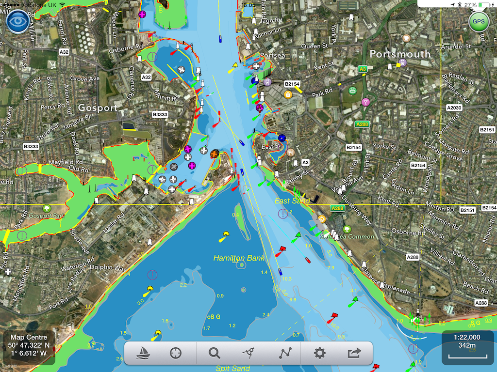
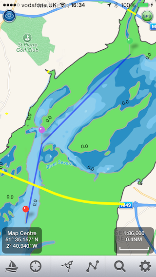
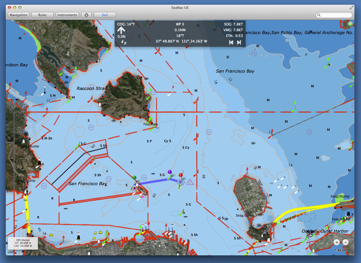
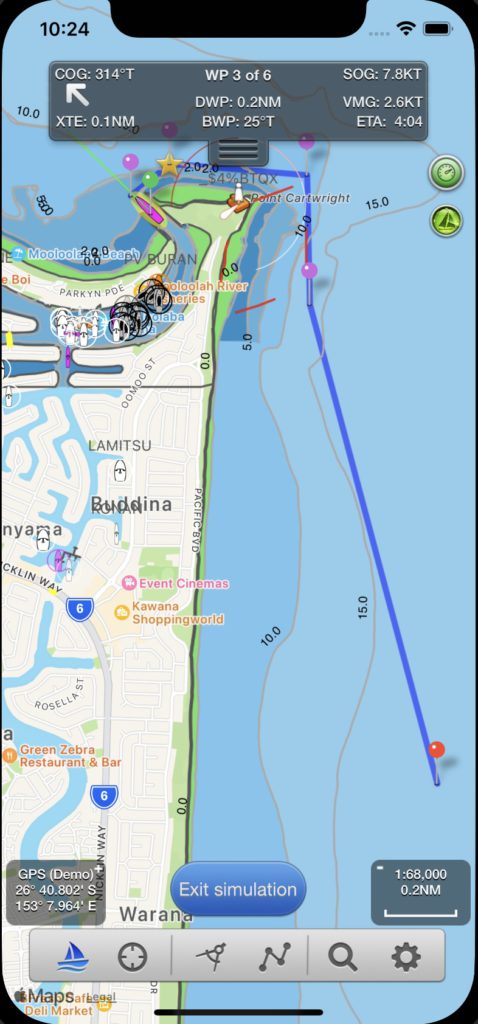
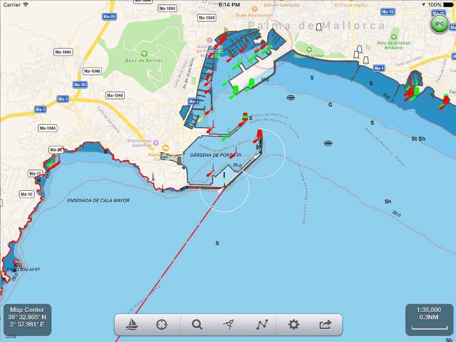
Here is a screenshot of the new Lake Champlain chart around Burlington.

Screen Shot 2014-06-17 at 12.40.32

The full list of new charts is given below with their name, update date and NOAA ENC Chart number:-

Goodnews Bay, 2014-03-31|US4AK84M

San Francisco Bay to Antioch, 2014-06-06|US4CA17M

Gambier Bay, Stephens Passage, 2014-01-02|US5AK0BM

Bay of Pillars and Rowan Bay, Chatham Strait;Washington Bay, Chatham Strait, 2014-05-05|US5AK0FM

Southern Entrances to Sumner Strait, 2014-03-20|US5AK41M

San Christoval Channel to Cape Lynch, 2014-03-18|US5AK44M

Foggy Bay and Ryus Bay, 2014-03-13|US5AK49M

Northern part of Tlevak Strait and Uloa Channel, 2014-03-31|US5AK4DM

N. end of Cordova Bay and Hetta Inlet, 2014-05-08|US5AK4IM

Harbor Charts-Clarence Strait and Behm Canal Dewey Anchorage, Etolin Island;Ratz Harbor, Prince of Wales Island;Naha Bay, Revillagigedo Island;Tolstoi and Thorne Bays, Prince of Wales ls.;Union Bay, Cleveland Peninsula,  2014-05-28|US5AK4OM

Alitak Bay-Cape Alitak to Moser Bay, 2014-04-01|US5AK5MM

Bays and Anchorages, Kodiak Island Karluk Anchorage;Larsen Bay;Uyak Anchorage, 2014-05-27|US5AK5SM

Rockport Landing and Shelter Cove, 2014-03-07|US5CA15M

San Francisco Bay to Antioch, 2014-04-11|US5CA17M

Half Moon Bay, 2014-02-24|US5CA53M

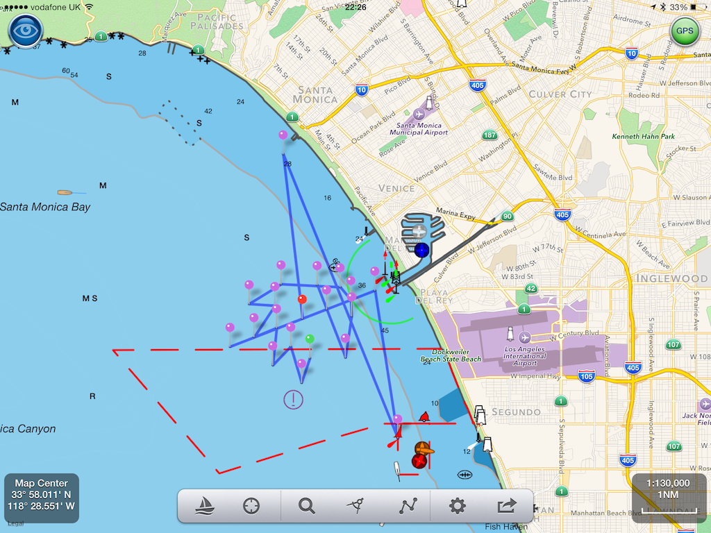
El Segundo and Approaches, 2014-05-15|US5CA59M

Santa Monica Bay;King Harbor2014-04-11, 2014-05-15|US5CA63M

Santa Cruz Channel, 2014-03-27|US5CA66M

Anacapa Passage;Prisoners Harbor, 2014-03-18|US5CA67M

Trinidad Harbor, 2014-02-06|US5CA91M

Albion to Caspar, 2014-01-30|US5CA93M

Cape Mendocino and vicinity, 2014-03-04, 2014-05-22|US5CA95M

Bodega and Tomales Bays;Bodega Harbor, 2014-05-29|US5CA96M

Drakes Bay,  2014-04-17|US5CA97M

Lake Tahoe, 2014-05-12|US5CA98M

Lake Mead, 2014-04-08, 2014-05-27|US5CA99M

Suisun Bay Middle Ground to New York Slough, 2014-01-29|US5CA9AM

Ossabaw and St. Catherines Sounds , 2014-04-10, 2014-06-05|US5GA16M

St Marys River – Vicinity of Neebish Island, 2014-02-10|US5MI50M

Stoneport Harbor and Presque Isle Harbor, 2014-03-04|US5MI66M

South Haven;Port Sheldon;Saugatuck Harbor, 2014-01-30|US5MI89M

Morristown, N.Y. to Butternut, Ont., 2014-01-17|US5NY61M

Butternut Bay, Ont., to Ironsides l., N.Y., 2014-01-17|US5NY62M

Ironsides l., N.Y., to Bingham l., Ont., 2014-01-17|US5NY63M

Gananoque, Ont., to St. Lawrence Park. N.Y., 2014-01-17|US5NY64M

Round I., N.Y., and Gananoque, Ont., to Wolfe I., Ont, 2014-01-29|US5NY65M

Las Mareas, 2014-02-07|US5PR41M

Port Royal Sound and Inland Passages, 2014-04-10|US5SC21M

Riviere Richelieu to South Hero Island, 2014-05-01|US5VT01M

Cumberland Head to Four Brothers Islands, 2014-05-01|US5VT02M

Four Brothers Islands to Barber Point, 2014-05-01|US5VT03M

Barber Point to Whitehall, 2014-05-01|US5VT04M

Burlington Harbor, 2014-05-01|US5VT05M

SeaNav – Marine Charts & Nautical Navigation App for Mac OS X

The newest member of the SeaNav app family brings our acclaimed marine charts to Mac – letting you explore and plan your boating trips on your Mac, then export your route to your iPhone for navigation while at sea – or plug in a GPS unit, and navigate with your laptop and our hi-res vector charts. SeaNav for Mac US has the latest NOAA ENC Digital Vector Marine charts covering the whole of the USA and Great Lakes, SeaNav for Mac UK has the latest UKHO UK and Ireland vector charts. SeaNav for Mac is exclusively available on the Mac App Store.

  • Includes NOAA US Coastal, Great Lakes and USACE Inland Charts.
  • Buoys, lights etc. are tappable with bearing and distance.
  • Seamless fast panning and zooming across charts.
  • Route Planning and tracking with Waypoints, SOG, COG, ETA etc.
  • Charts work offline
  • Route export, import and sharing (KML, share via disk or Dropbox)
  • Live AIS Ship positions
  • Share routes and tracks with SeaNav on iPhone and iPad

SeaNav uses the latest Digital Vector charts providing a wealth of benefits and advantages over raster charts. Buoys, Lights, Bridges, Depth Contours, Depth Soundings, Rocks, Anchorage areas, NOAA Weather Buoys etc. are all selectable and have real time distance, bearing and detail information. Turn off layers to de-clutter the display and only show what is important at the time. Tides, moon and sun times and weather are also all available at your fingertips.

SeaNav Mac Sailing

SeaNav lets you measure distances and bearings and record waypoints on routes. When at sea, the app’s Sailing HUD shows your position, Course over ground (COG), Speed over ground (SOG), Vector Made Good (VMG), Estimated Time of Arrival (ETA), Distance and bearing to next Waypoint. Waypoint reached alerts, auto-routing to the next waypoint and collision alerts.

SeaNav is also available for iOS, so you can plan a route on your Mac and share the route with your iPhone or iPad – or take your iPhone sailing, then send your track back to your Mac.

Plug in your GPS unit and go – SeaNav works with Bluetooth and serial GPS units, and those which provide location or AIS service via TCP or UDP or TCP, including devices from Lowrance, Simrad and B&G GoFree. But GPS is only required for real time route navigation, you can plan routes without GPS then send them to your iPhone for use while at sea. SeaNav’s optional Real time AIS, Tides and Weather information require an active internet connection.

Your purchase of SeaNav includes 12 months free updates to the included US chart set.

SeaNav for Mac is exclusively available on the Mac App Store.

Navionics Boating (free US NOAA Charts) vs SeaNav

Navionics have  launched a new version (7.0) of their Navionics Boating app which now includes free US NOAA vector charts. If you are boating in the US you can now get a well respected and functional marine navigation app on your iPad and iPhone without spending a cent. What are they up to? Why should you go anywhere else? How can they give away a full blown marine navigation app for free? We hope the following comparison  and charts around San Francisco can help you decide which route to follow.

Here is the view of San Francisco from SeaNav within a 3 mile radius  – the horizon for most leisure boat users (6NM x 6NM square) :-

and the same scale on Navionics Boating with their free NOAA charts :-

What?

We zoomed in and eventually (at three times the scale) details appeared:-


Compare this with SeaNav at the same scale:-

We hope you will agree that its a lot less cluttered, has more relevant information and is a lot easier to view. Zoom in and more details and spot depths will be shown. You can also choose what level of detail to show in SeaNav.

Other key differences:-

  • SeaNav includes full live navigation features including COG, SOG, HDG, ETA, Waypoint distance and time, Cross Track error, Course and North up view etc. – it’s at least a $5 extra for Navionics and that doesn’t get you much of what SeaNav offers.

  • SeaNav includes Tides – Navionics Boating free doesn’t – you have to buy their  USA chart set  at $70.

  • SeaNav has a unique and highly recommended AR Camera view showing buoys, ships, landmarks  etc. overlaid on the real time camera view.

  • SeaNav has free support for the amazing fully waterproof Pebble SmartWatch – forget a $500 Garmin Quatix!

  • SeaNav has live AIS Ship data overlay including collision detection. (via Boat Beacon).

  • SeaNav – buy once  and runs at full HD on both your iPad and iPhone with no need to purchase another version.

  • SeaNav including full charts is just $19.99 in the US and £14.99 in the UK. See how this unfortunate user ended up paying over £70 ($100) for Navionics “Free”:-

And, SeaNav iPhone and iPad is now available for you to try for free. Click here to learn more.

(SeaNav is also available for Mac)