

Check out the pictures these guys are posting on their Twitter feed…
https://twitter.com/
Sheerness Lifeboat!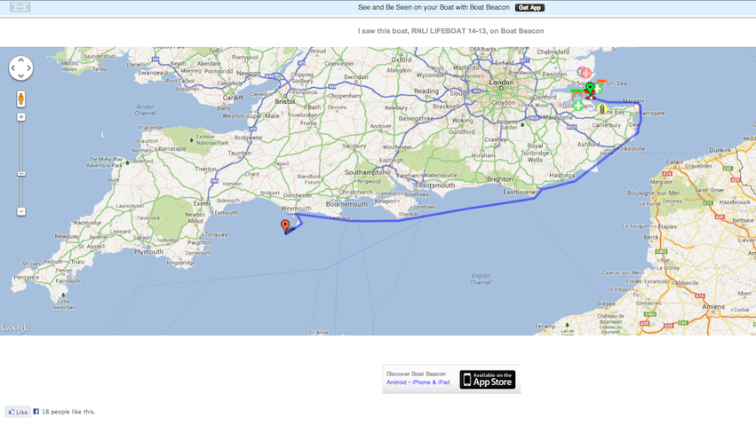
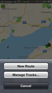
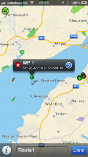
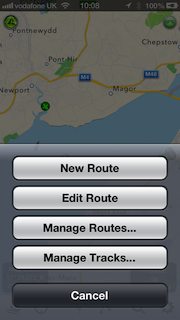
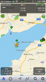
Wales, UK – Pocket Mariner’s recently launched SeaNav app, with versions for both the US and UK/Ireland, has been updated to offer a more complete charting and navigation toolkit for boaters. To improve navigation and collision avoidance when out of reach of cell phone coverage, SeaNav — together with Pocket Mariner’s Boat Beacon app — can now also use on-board live VHF AIS data feeds. The app also now enables sailors to jump directly to specific locations using latitude and longitude searches and has been extended for use on iPods as well as iPhone and iPad.
SeaNav was designed to enable boaters to explore, plan and navigate their boating trips in real-time and high-resolution using the latest up to date Digital Vector Marine charts covering the US coastlines and Great Lakes or the UK and Ireland. Pocket Mariner has successfully completed sea trials of the new local AIS feature with Lowrance, Simrad and B&G’s GoFree™ wireless systems, as well as with easyAIS and Digital Yacht.
Robert Langford-Wood Product Manager for GoFree Technology said: “Applications such as SeaNav and Boat Beacon, when combined with GoFree wireless, allow boaters to make the most out of their Lowrance, Simrad and B&G chartplotters and AIS systems away from the helm. It means that every member of the crew can have a navigator’s eye view, increasing safety and enjoyment out on the water – a great innovation!”
SeaNav works best when paired with Pocket Mariner’s Boat Beacon, which has become an enormously popular app among sailors for its simple-to-use location sharing and real-time “Map View” of both the user’s and other nearby boats via AIS. Together, SeaNav and Boat Beacon provide a powerful set of charting, navigation and location-sharing tools. While Boat Beacon provides SeaNav with its AIS data and alarms, Boat Beacon gets marine charts and routes from SeaNav. The two apps share hot-jump buttons that ensure they are both on the same location and at the same zoom level on the map.
Key features of SeaNav include:
• Route Planning and real time tracking including Waypoints, SOG, COG, ETA, CTE etc.
• Route and Track export, import and sharing.
• Charts downloaded and stored on device so they work without mobile coverage!
• Seamless fast panning and zooming across charts.
• Live AIS Ship positions overlaid from Pocket Mariner’s Boat Beacon app.
• Configurable layers; buoys, lights, depths, rocks, wrecks, anchorage areas etc.
• Automatic Chart updates.
SeaNav has two versions, SeaNav US which uses NOAA charts providing complete coverage of USA and Great Lakes and free chart updates for life. SeaNav UK uses UKHO Admiralty charts and includes the complete set of charts for the UK and Ireland plus a year of free chart updates in the one-off price. New versions of the app with charts for other countries and regions are in the works.
Both versions are available from the App Store for iPhone, iPad, and – in this latest version – on an iPod touch, for US$9.99 and £9.99 in the UK.
For more information, visit PocketMariner.com. or email steve@pocketmariner.com
Live screenshots testing Boat Beacon in the Solent
Our test boat!
Live view from Boat Beacon: the test boat is the purple boat in the centre, while the Ferry is blue to port
View of the blue target (Ferry) from bridge of our boat.
About Navico: Navico is currently the world’s largest marine electronics company, and is producing products under leading marine electronics brands: Lowrance, Simrad and B&G. Navico has approximately 1,500 employees globally and distribution in more than 100 countries worldwide. www.navico.com
We recently received an excellent review of Boat Beacon in the German Yacht magazine including some great screen shots. It generated a lot of interest with German boaters.

I wrote to the author to ask if we could use his screen shots in the iTunes store. We received a lovely reply:-
“I am the author of the review at yacht.de. I bought and tested the app on a voyage from Emden (western Germany) to river west of Hamburg – and I was very impressed by the app. We sailed the whole night through with a lot of wind and high waves. My father was with me on board, his first time on the north sea – and he got seasick the moment we left sheltered water. So I sailed singlehanded and Boat Beacon was a great help. As the boat has no AIS-System attached to the plotter, it was very helpful to have it on the iphone. Also to be able to find out in which direction the other ships were heading when I saw us on collision course. The friends and family followed our progress at home on the computer. One friend even followed us sailing up the river Oste and sent me the phonenumbers for the bascule bridges the moment we reached them.”
BoatU.S. have reviewed Boat Beacon and lists it first of the 4 Best Apps To Keep You Safe On The Water
We popped down to the Southampton Boat Show to share our wares and look for new App ideas. We also got a chance to take Boat Beacon out for a spin on a $1M Speed boat and test at high speed!
Here are some real time screen shots from the boat and of Boat Beacon’s display. All lined up in real time perfectly. We are on the purple boat in the centre of the screenshot doing just over 20Kts overtaking Red Falcon which is to port.
We met up with Yachting Monthly Editor, Keiran Flatt and he is going to publish our Marine Apps survey on-line and in the next print edition and he also had some ideas for new Marine Apps he would like to see. He is thinking of setting up a photo shoot and story about our company with a trip down the Wye to the Severn from our offices on Sarita.
A fantastic day and some great new ideas and opportunites for Boat Beacon and for some new Apps.
by Steve Bennett, Captain, Pocket Mariner.
I sail a 30 foot Catamaran in the Bristol Channel, one of the most challenging areas of water in the World due to its high tidal range, currents and sandbanks – see http://www.bcya.org.uk/content/sailing-bristol-channel .
As with sailing in any waters, you need to keep in mind ports of refuge (most harbours dry), keep an eye on the weather (the channel faces West or South West, the direction of the prevailing winds) and keep a careful eye open for the very large vessels that use Bristol, Milford, Cardiff and Swansea.
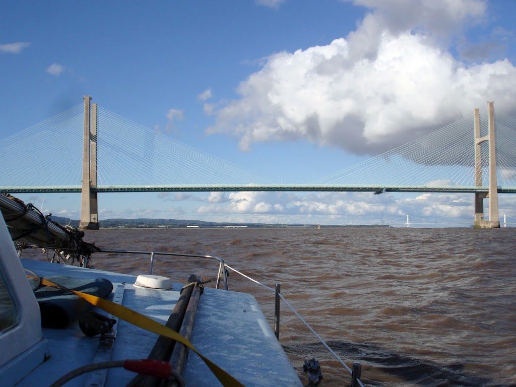
With a following tide of up to 8 knots these vessels can have a speed over ground (SOG) of over 25 knots (30 mph!) – 75,000 Tonnes approaching at 30mph! Judging their position versus yours as you approach the narrow Channel under the Severn Bridge is challenging even in good visibility – in poor it’s beyond scary! It’s vital you keep out of their way because they can’t turn or stop quickly! At 25 knots they can appear from over the horizon in less than 5 minutes. Survival depends on you spotting them and getting out of the way. Even if they could see you they probably couldn’t avoid you in time – you just “don’t want to mess with them”!
The International Maritime Organization‘s (IMO) International Convention for the Safety of Life at Sea (SOLAS) requires AIS to be fitted aboard international voyaging ships with gross tonnage (GT) of 300 or more tons, and all passenger ships regardless of size. AIS works a bit like radar, but better. Ships continuously transmit their details and position and can be displayed on a live map display.
The Ship AIS units cost thousands of dollars. Small AIS receivers are available for around $400 which will allow you to show these boats on a computer screen including their course, speed and their MMSI – Marine Telephone Number – so you can call them up on VHF radio. But, that requires a large outlay and a computer screen or an even more expensive dedicated unit or Chart Plotter.
Worse than that there is also the horizon problem. An AIS receiver can only see as far as the horizon. For an aerial mounted at deck height as many are, the horizon is about one nautical mile away ( http://en.wikipedia.org/wiki/Horizon ). A ship with its AIS aerial at 10m above sea level has a horizon of about six miles. With an approach velocity of 28 knots it could be upon you from nowhere in 15 minutes. This is where the network of shore-based AIS systems come to the fore. As long as you are within GSM coverage and there are AIS shore stations in your area then you can pickup AIS via the Internet and not only see over the horizon but anywhere in the world.
There were already a couple of iPhone apps available which will receive internet AIS data and plot ships’ positions over a Google map. One such app, widely used by sailing fans (though not necessarily sailors themselves) love it for spotting, watching and learning about ships around the world from their desk or the harbour-side cafe. It has even been featured on CNN. I tried using it in the Bristol Channel and it was a decent app, but it’s clearly aimed at landlubbers and there were several key features that, as a Skipper, I needed from an AIS app that this kind of app doesn’t provide. Collision Detection in the background and being able to transmit and share my position on global AIS systems Being the two most important.
I wanted to be alerted if I was on a potential collision course with another boat that I might not even be able to see yet and I didn’t want to have to keep checking a screen every five minutes.
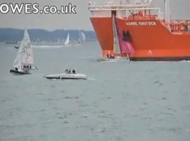
There have been several collisions between small boats and ships reported over the last year. Fortunately no one has been seriously injured in the recent one below in the Solent at Cowes
I have been developing apps for mobile devices for over 15 years and decided to put that experience to the task of creating an ideal app for sailors like me – with the result being Boat Beacon. Not only will Boat Beacon display ships and their information on a Google map, it continuously monitors all ships within a 60 mile radius, 5 to 10 times further than a conventional AIS receiver on my boat could do, and calculates their Closest Point of Approach (CPA).
If any are going to be within 100m of me within the next 10 minutes, Boat Beacon alerts with an alarming Big Ship’s horn – plus a vibration and popup notification. We have tested it out in the Bristol Channel and on a misty day in the Solent and it has proved very reliable and accurate, with no false alarms and no missed alarms.
“It was fairly foggy with low vis so app was very useful. All worked well, the alarm was activated in good time and no false alarms as I saw it. Only had three alarms to deal with…………..I can see a new game emerging where one has to induce the collision alarm!”
and another from Lake Erie in the US:
“We did an interesting experiment yesterday while helping a friend bring his 42′ sailboat through the south passage of Lake Erie. On board: Ship Finder Iphone app. a Raymarine AIS driven by E80 MFD and the Boat Beacon. The results within a 40 mi range were: the Ship Finder app had the least number of targets (2) Raymarine AIS had 4 and Boat Beacon had at least 6. Interesting. Additionally the Boat Beacon had more detail on the targets such as Ship names etc. The only rationale for the mid performance of Raymarine AIS could be that some of the targets were on the other side of Kelly’s Island.”
Boat Beacon also has a host of other additional “Sailing” related features that I wanted:
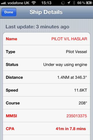 Potential Collision detected. Closest Point of Approach – 41 metres in 7.8 mins.
Obviously, Boat Beacon should only be used for basic navigation reference in Coastal areas where there is internet and shore-based station coverage. It should not be solely relied upon to determine precise locations, proximity, distance, or direction. There is no replacement for the Skippers’ and their crews’ eyes and the Skipper’s ultimate judgement.
There are some possible drawbacks with relying on an Internet-based AIS for Coastal Navigation. It relies on you having Internet coverage, however most popular coastal areas in the US have cellular data access extending 12 or more miles out to sea. The UK has nearly complete coastal coverage out to 12 miles. It relies on AIS shore stations covering your area. The network of stations Boat Beacon can access covers the majority of popular coastal and harbour areas. It typically has live data available on over 45,000 ships around the world and coverage is continually increasing. In the unlikely chance that there is no coverage in your area then club together, set up a shore station and join the network!
In some cases, shore-based receivers can be provided for free – see Cover my area for more information. Another reservation is that you won’t show up on the big ships’ AIS systems unless they have an Internet AIS feed too. However, as I mentioned earlier, even if they can see you they are unlikely to be able to do much to avoid you in time!
The tag line for Boat Beacon is “See and be seen on your boat in Coastal Sea areas with 60 mile Collision Avoidance using just your iPhone or Android device. Lets you keep a watch on boats near you and others keep a watch on you using Boat Beacon and Global AIS systems.”