Get live AIS ship positions around you on the Navionics Boating app without the need for an AIS receiver.
Boat Beacon can now share its real time AIS feed from our global AIS aerial network via NMEA with Navionics on the same device or on the same Wifi Network. Boat Beacon acts as a “Virtual AIS Receiver” and is the first and currently only app out there that offers this .
Navionics have worked closely with us on this with their Boating app AIS feature and recommend Boat Beacon in its own category in their Boating app – AIS Devices Compatibility Guide.
The new Boat Beacon AIS Share feature is free to try. If you find it useful you can use it any time when you are out boating for a small monthly or annual subscription via IAP.
You can get the latest version of Boat Beacon from the Apple App Store here and Google PlayStore here.
This is a step by step guide on how to configure Boat Beacon AIS Sharing with Navionics on Android (there is an iOS guide here). The AIS Sharing feature includes a free no obligation 3 day trial so you can try before you buy.
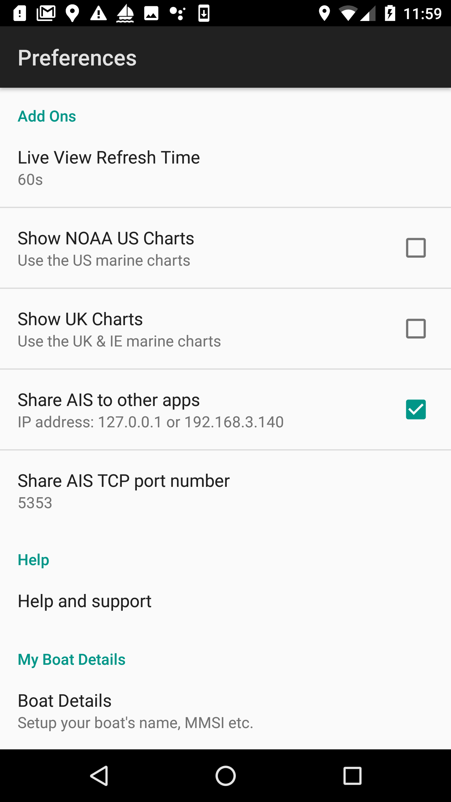
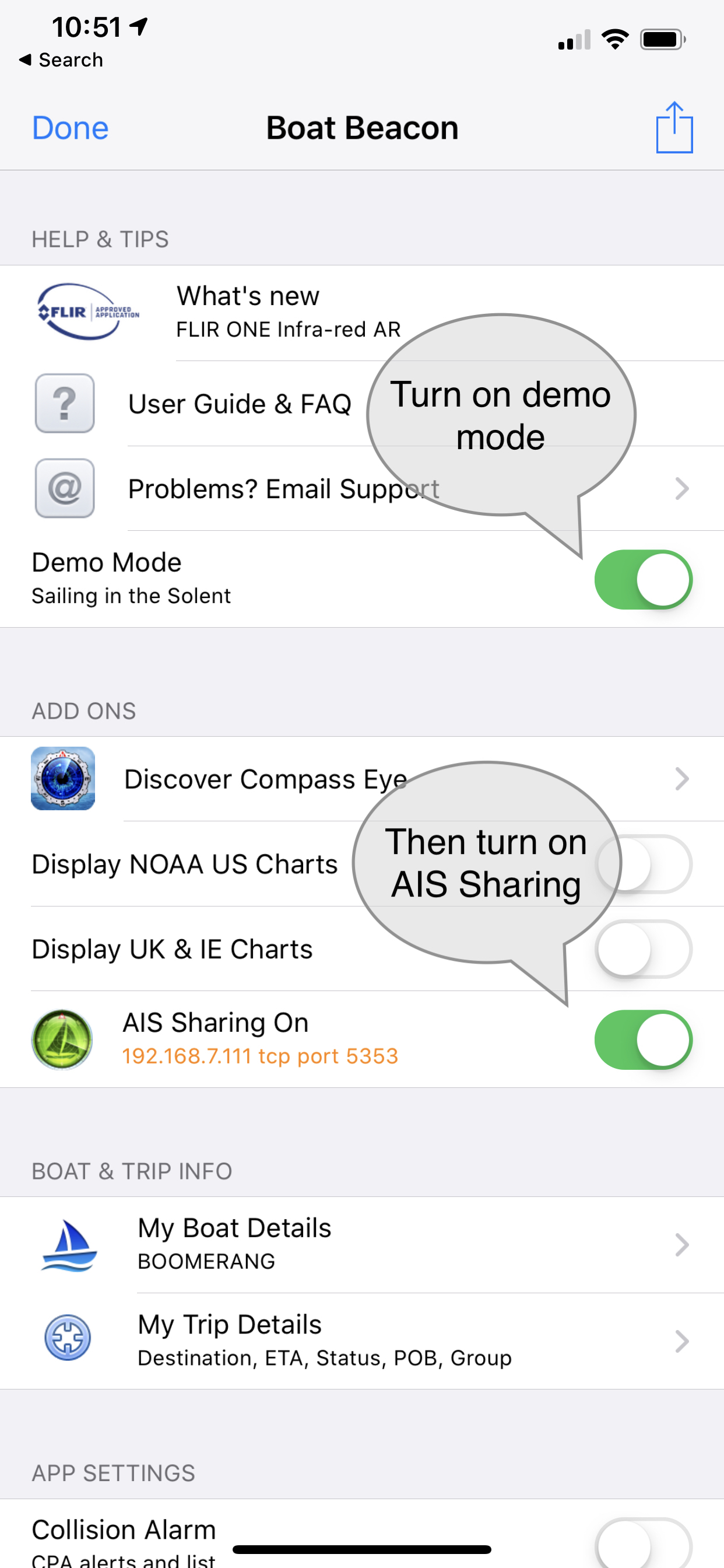
1. Launch Boat Beacon and go into Boat Beacon settings and tap “Share AIS to other Apps”. You will be offered a free three day trial with one of the two subscription period options. There is no charge if you want to cancel before the end of the trial period. Next set ‘Share AIS’ on.
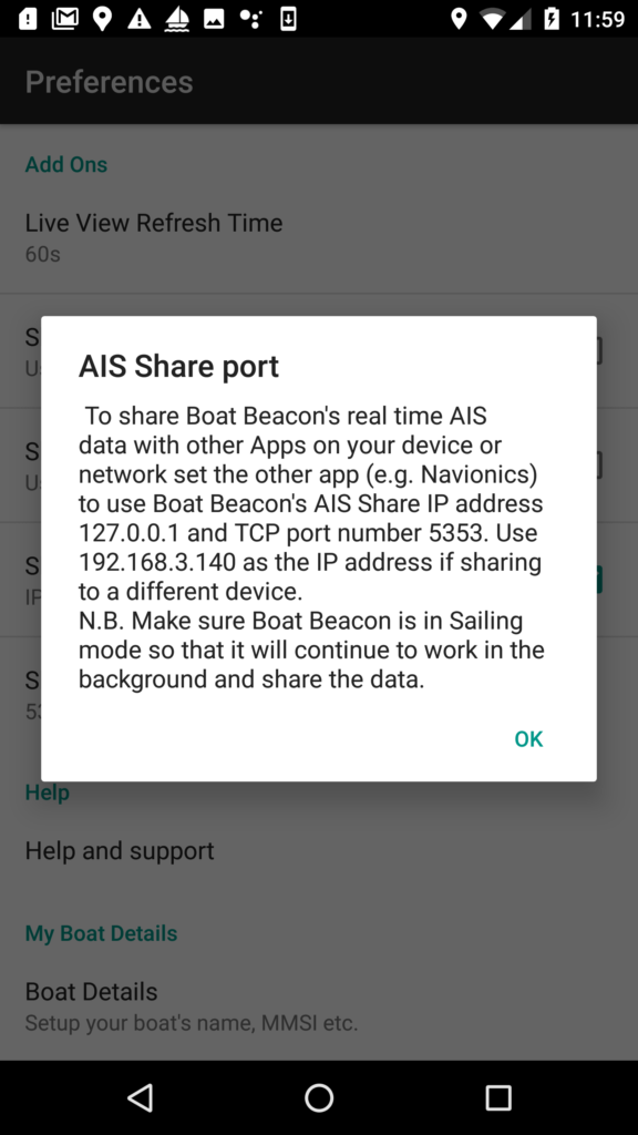
You will see this prompt advising the settings to use in Navionics.
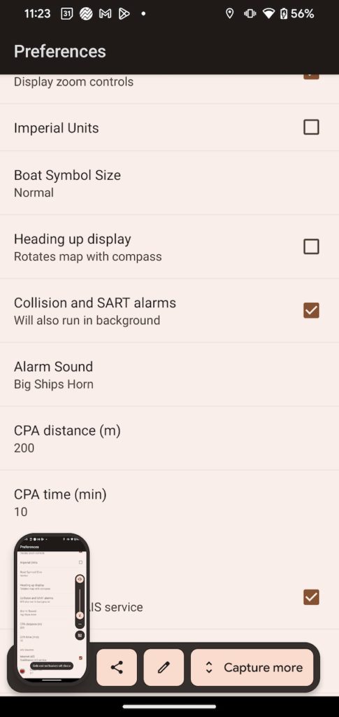
Also make sure that Collision and SART alarms is enabled in Boat Beacon Gerenral settings ( it is by default) so that Boat Beacon will continue refreshing ship positions when in the background.
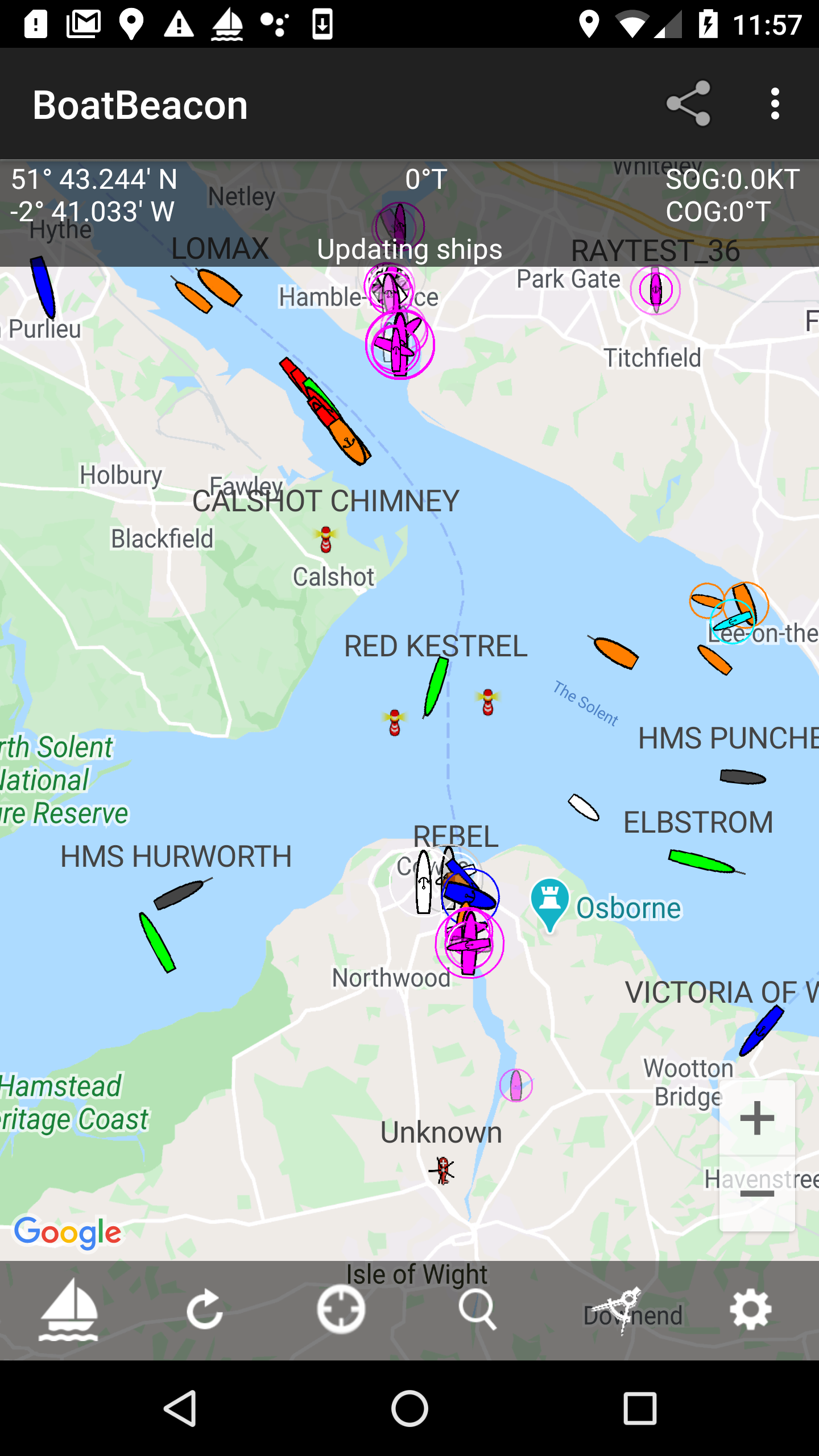
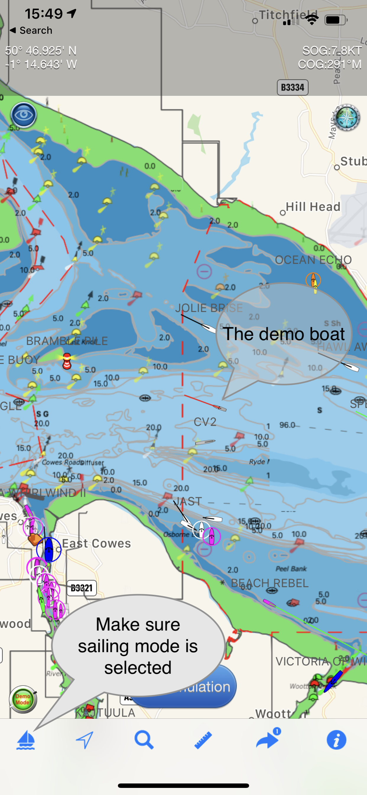
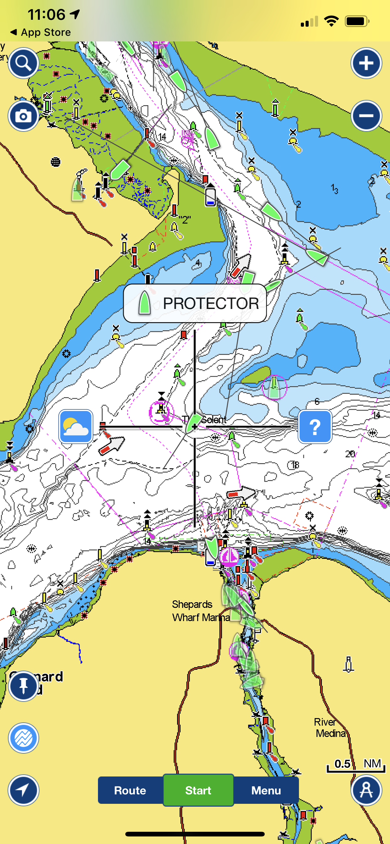
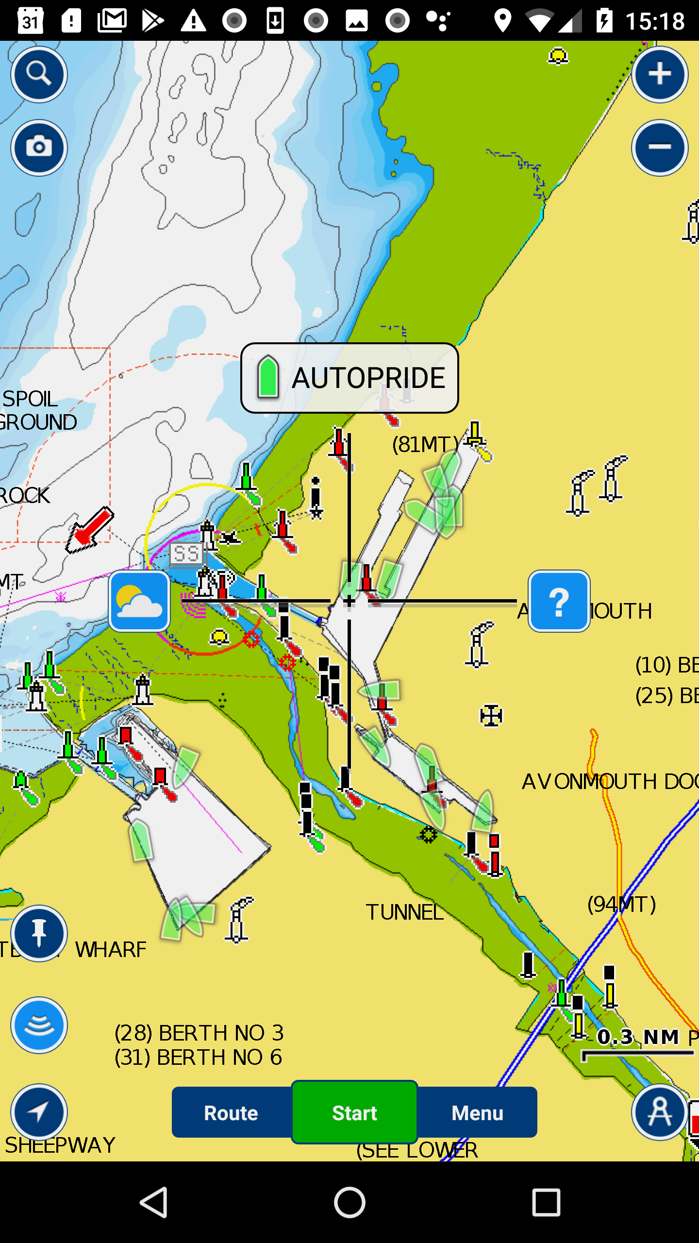
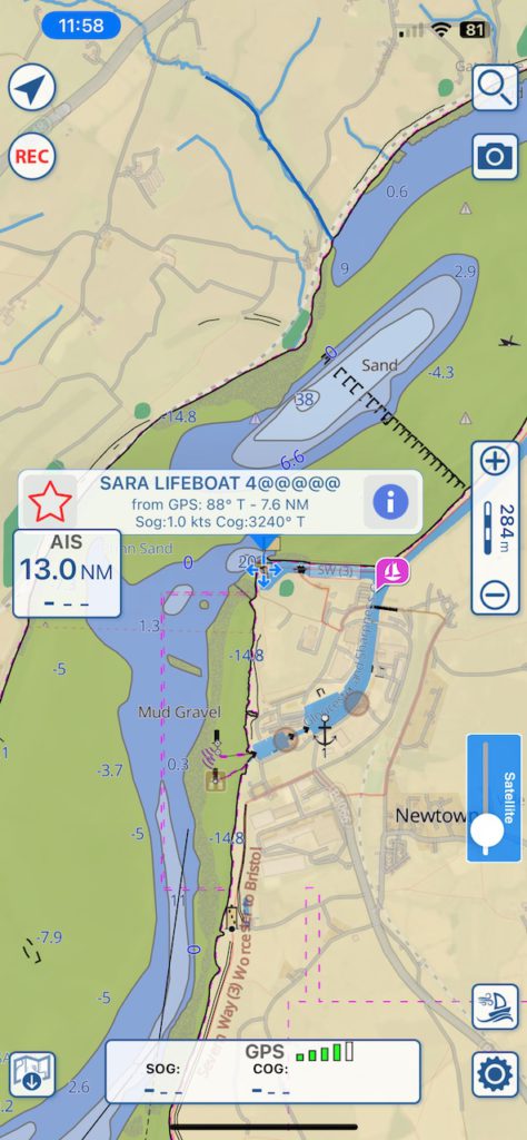
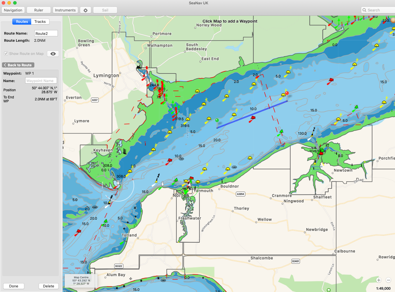
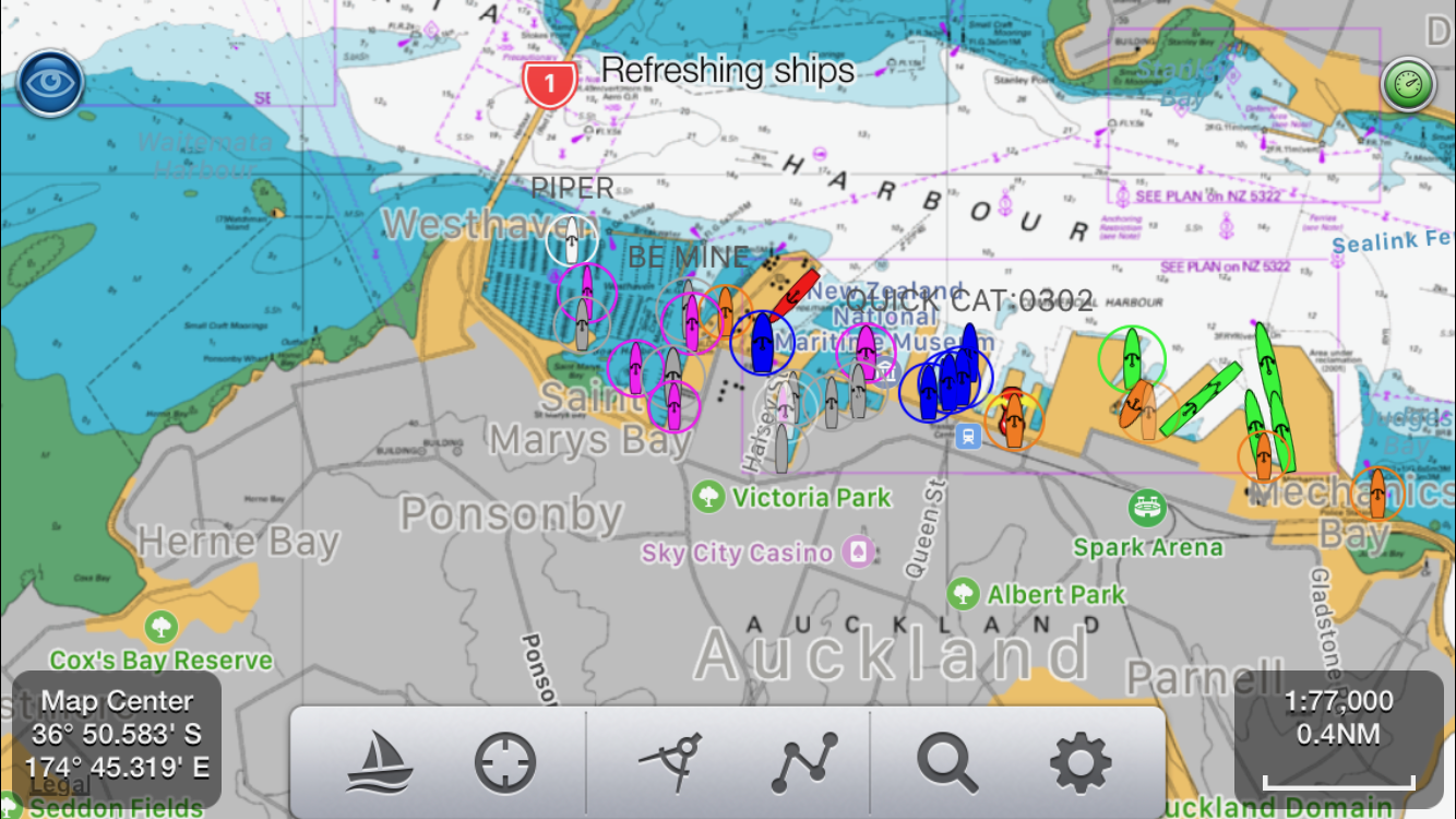
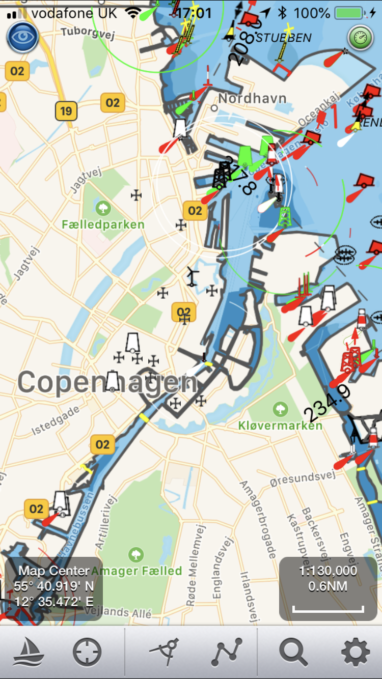
Tap OK, go back to the map view and set sailing mode on (Sailboat icon bottom left). This will position Boat Beacon on your current GPS location. Here I am positioned in the Solent in the UK aboard the Red Kestrel. (*N.B. See notes below if there are no ships within 30 miles of your GPS location and you need to pan the map to a location away from your GPS position to see ships).
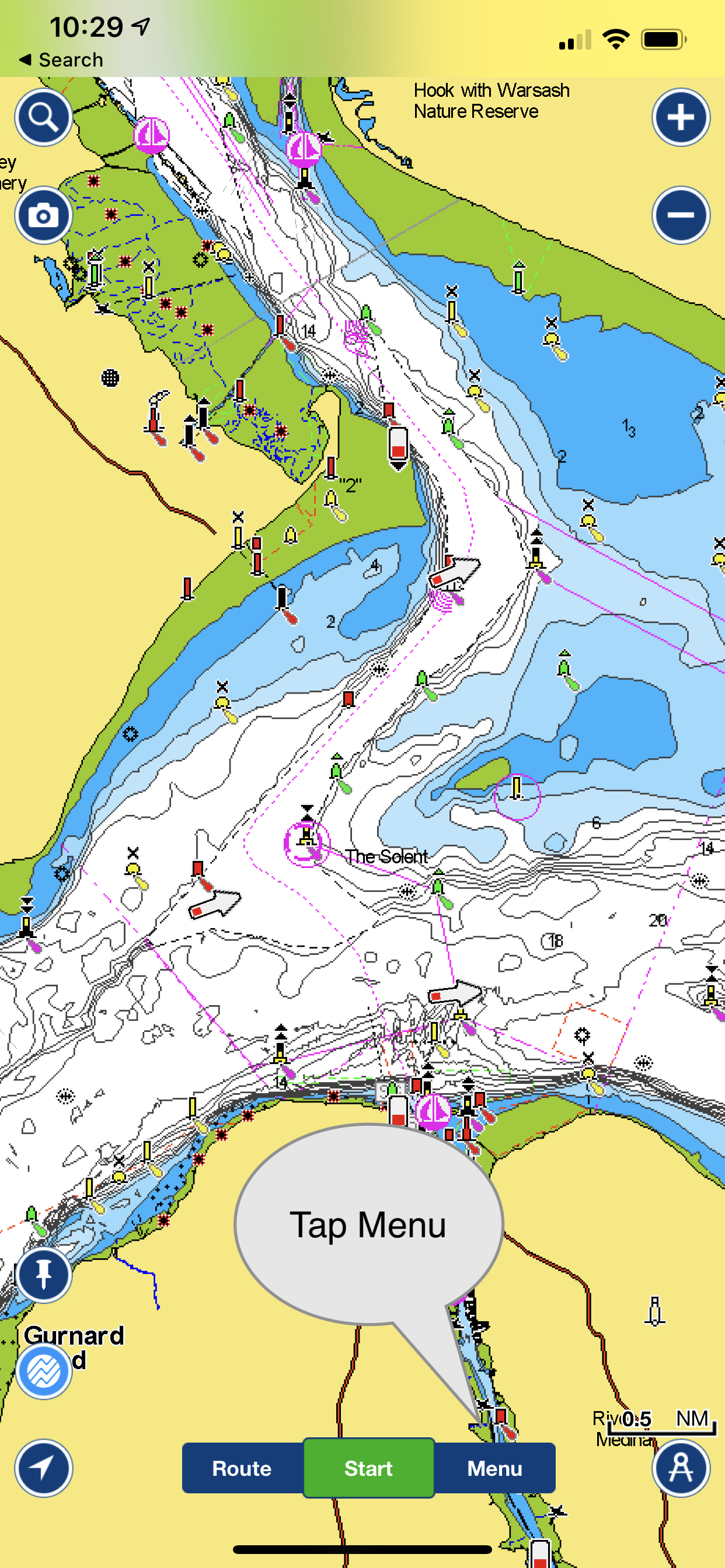
2. Now switch to the Navionics Boating app (on the same device) and position the Navionics map on your GPS position and then tap Menu so you can configure AIS.
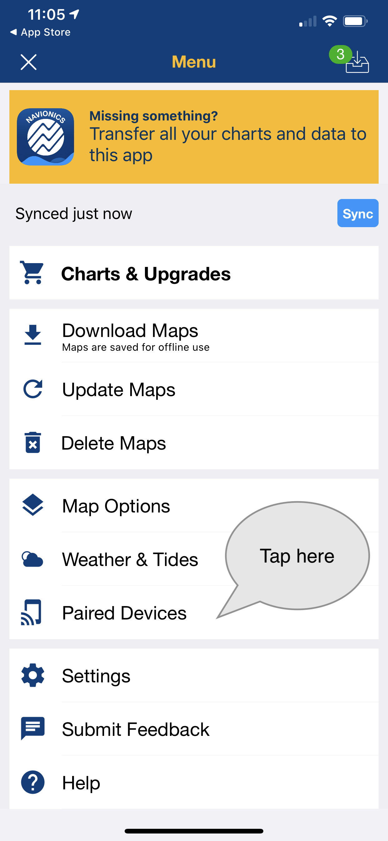
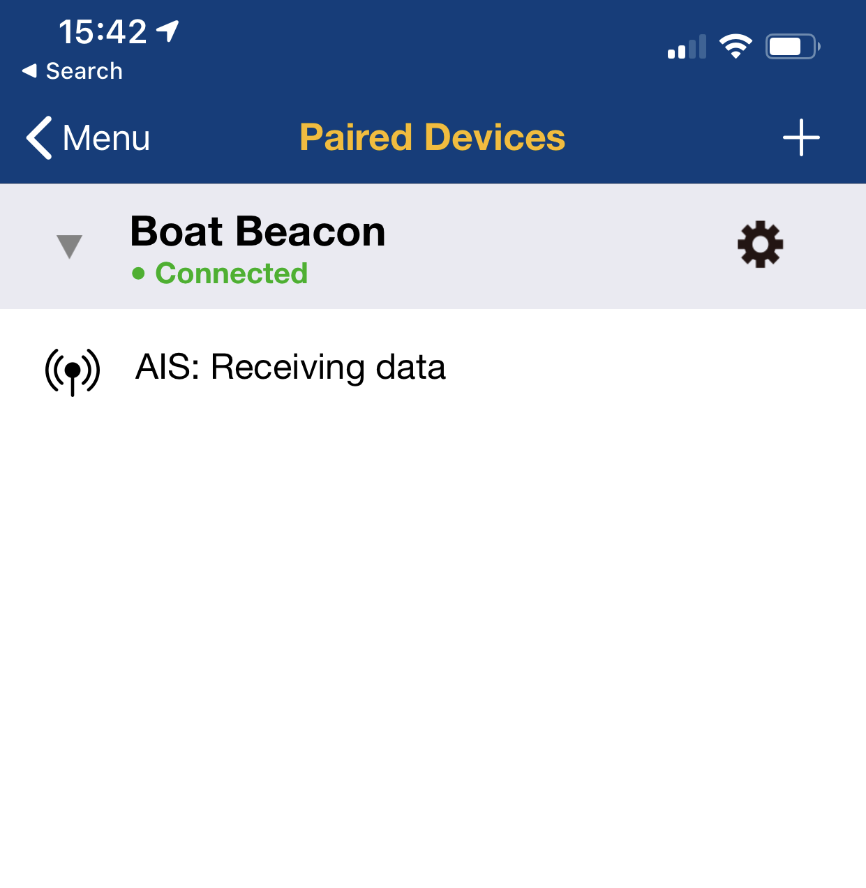
Scroll down to “Paired Devices”
You should then see this screen*, tap “Add Device” at the bottom.
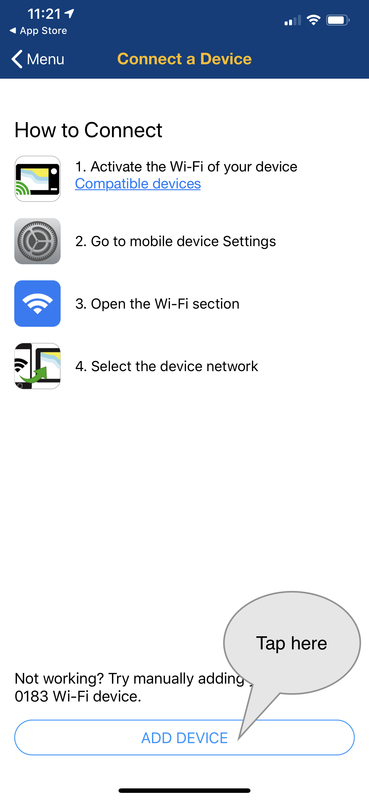
(* If you already have a device set up you can add another by tapping the + at the top right on the device list screen.)
 Fill out the Name as “Boat Beacon” ( or whatever you want to call the connection), the Host as 127.0.0.1 and the Port Number as 5353 and make sure the protocol is set as TCP.
 Tap “Save” top right and go back to the map view. You should now see live AIS boat and ship icons on the Navionics map. You need to have “Display AIS targets” enabled in the Map Options in Navionics.
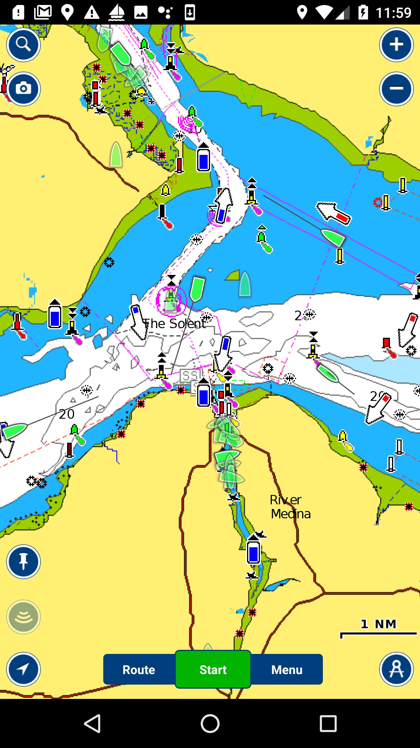
Now every time you run Boat Beacon in Sailing mode Navionics will automatically connect and receive the live AIS data from around your GPS location out to 30NM.
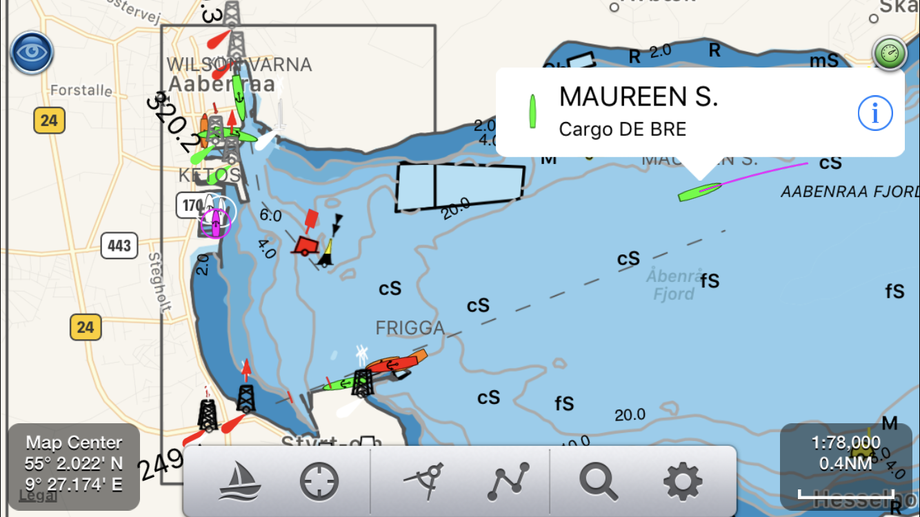
If you check back in Menu/Paired devices you will see Boat Beacon as Connected and AIS: Receiving data
Notes:
- *If you are trying this at home far from the sea and live vessel positions you can still see AIS ship positions from Boat Beacon in Navionics but they will not get automatically updated. Pan the Boat Beacon map to a location where there are live AIS targets. Set AIS sharing on and launch Navionics and pan its map to the same location. You will see the ships’ last positions from Boat Beacon. However they will not get automatically updated. The targets in Navionics will start showing red crosses as their AIS data gets old. This is because when Boat Beacon is running in the background it can only automatically update ship positions around your GPS location. If you re-visit Boat Beacon, refresh the map and then go back to Navionics the AIS targets will all be updated again.
- Boat Beacon must be in Sailing mode and Collision and SART alarms must be enabled to maintain the AIS feed when it is in the background ( e.g. when you are viewing the Navionics Boating app) on your device.
- Boat Beacon will automatically update AIS targets around your GPS location when it is running in the background.
- You do not need to have a WiFi connection to your device to use Boat Beacon and Navionics on the same device. You must have an internet connection though (e.g. Cellular/Mobile).
- You can share to Navionics on other devices too if they are on the same local WiFi network using the IP address shown in Boat Beacon’s AIS Sharing setting instead of 127.0.0.1 in the Navionics Devices setting.
- If you have any questions or problems getting it working please email us at help@pocketmariner.com


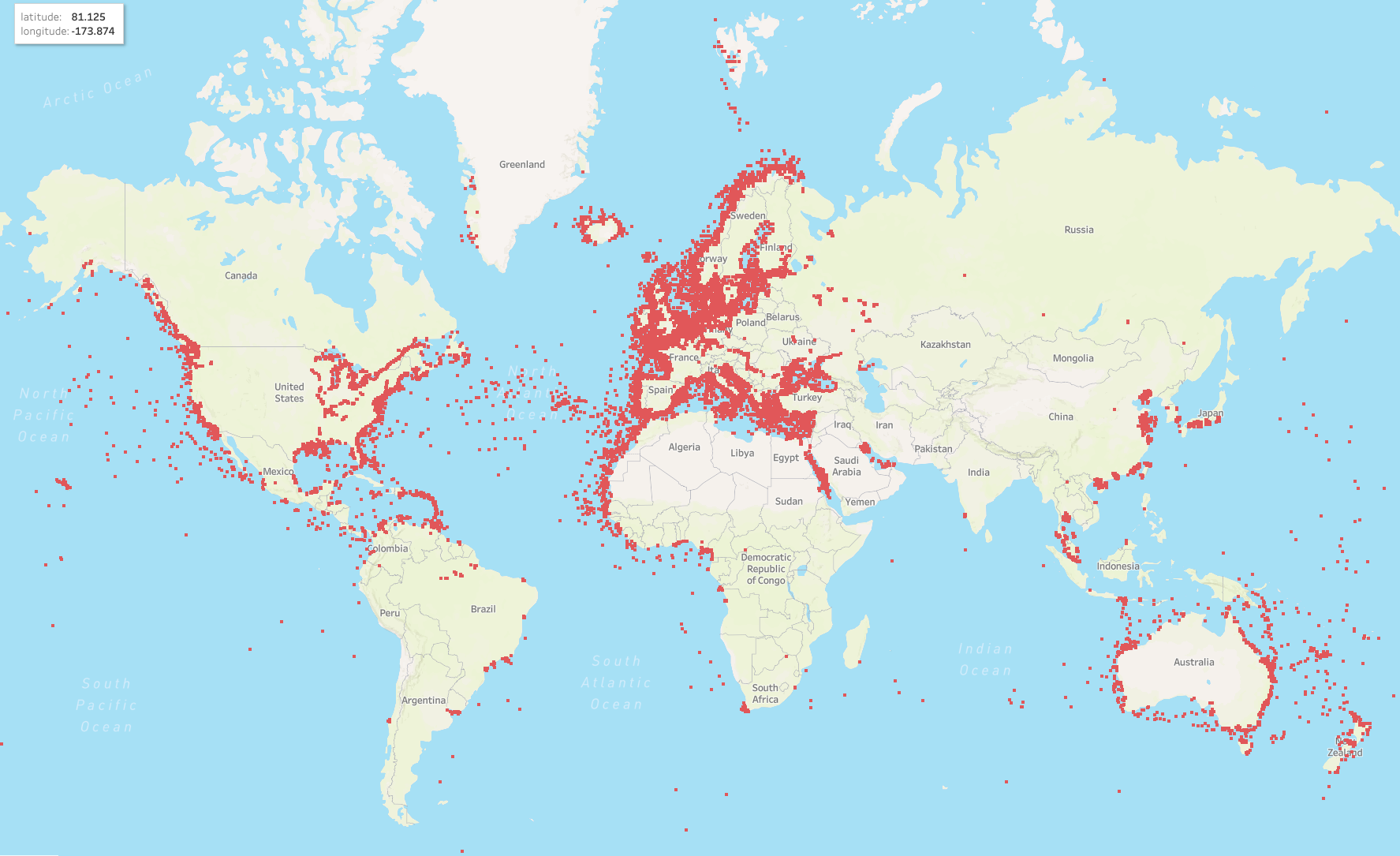
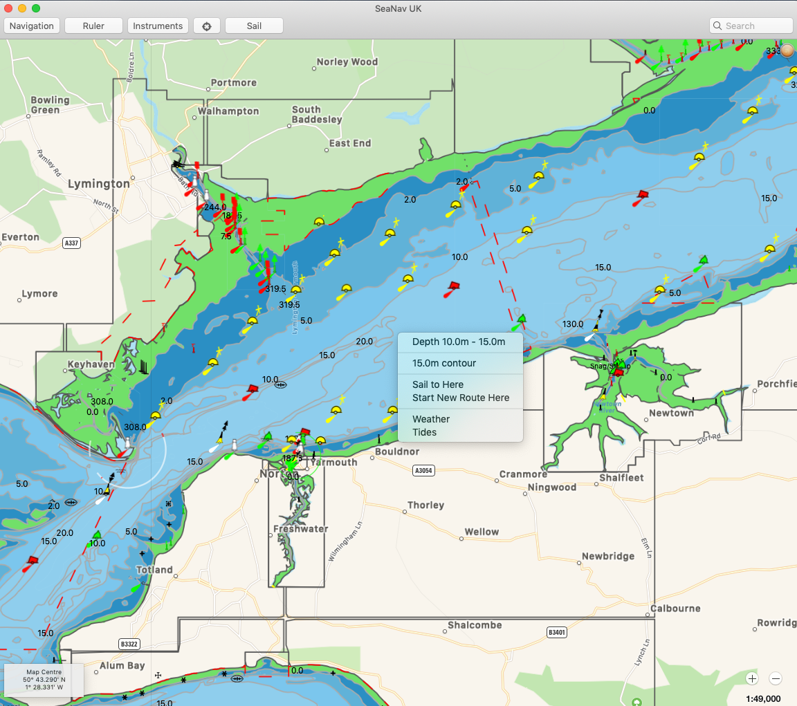
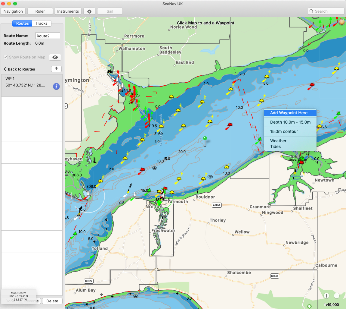
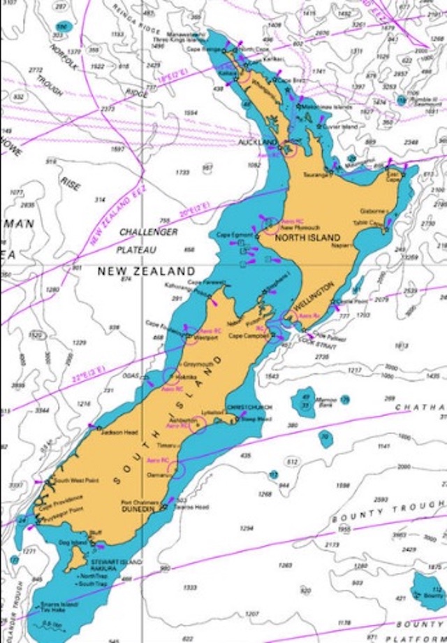

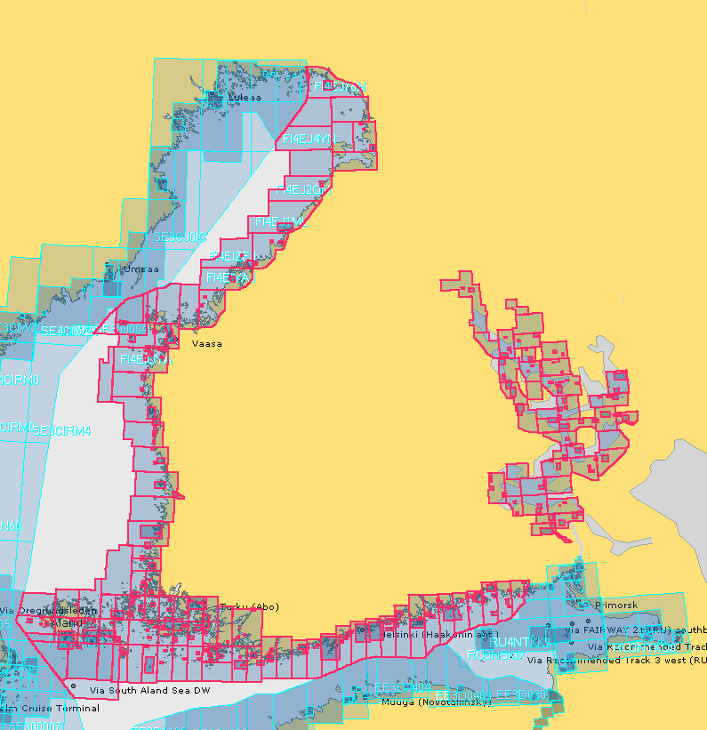
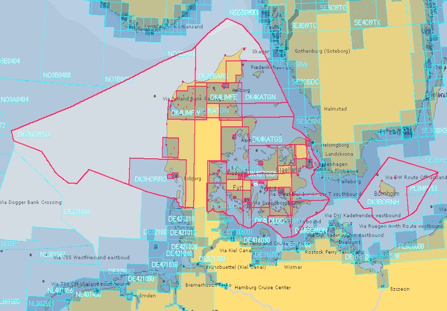
 SeaNav now has UK, IE, NL, BE, FR, DE, ES, US and CA charts available with complete coverage across the English Channel and we now have continuous coverage from Nantes in France through Belgium and the Netherlands, across Denmark and Germany including the German inland waterways. Current European chart coverage is outlined in red below.
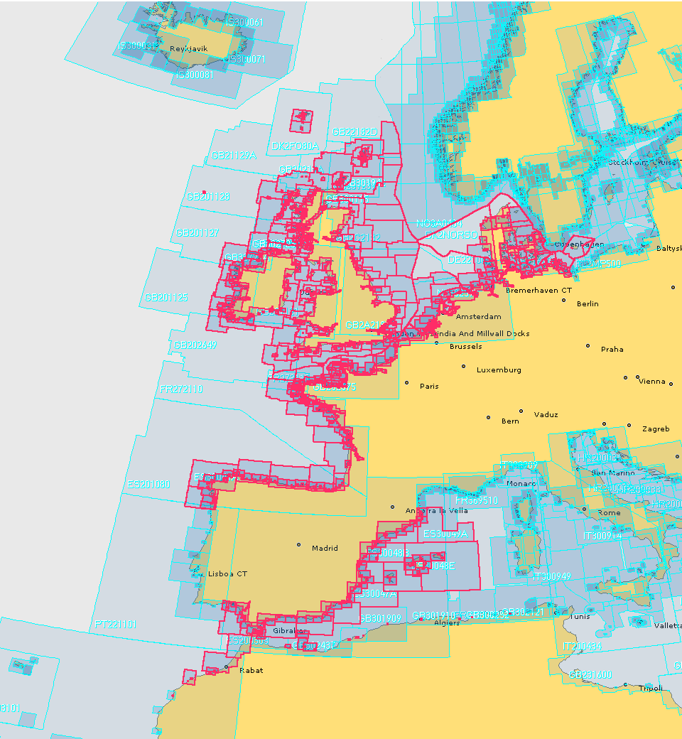
 general
 hazard
 fishing spot
 diving location
 race markers for club racing
 favourite harbour or anchorage spot
 bridge