Here is how to import a list of Latitude and Longitude positions as a set of waypoints and route into SeaNav.
Step 1. Create a spreadsheet with the Latitudes and Longitudes either in Degrees, Minutes, Seconds, Degrees Minutes or Decimal degrees with a header line including latitude and longitude and a name field like so:-
| Latitude | Longitude | Name |
| 28 52.634 N | 95 14.139W | Test 1 |
| 43°38’19.39″N | 116°14’28.86″W | Buoy 2 |
| 43 38 19.39 | -116 14 28.86 | SBH Buoy |
| 43.63871944 | -116.2413513 | Finish |
You can use any of the following formats for the coordinates
DMS, DM, Decimal Degrees etc.
DMS: 43°38’19.39″N
DMS with no symbols (use – sign for West or South): 43 38 19.39
DM : 28 52.634
Decimal degrees : 43.63871944444445
I use google docs to create the spreadsheet and then download it as an excel spreadsheet to my desktop.
Step 2. Then upload the xlsx file to
https://www.earthpoint.us/ExcelToKml.aspx (you do not need a login to use it)
By tapping choose file and browsing on your desktop to where you downloaded the spreadsheet. You can check it will convert ok before clicking “View on Google Earth” by tapping the “View file on web page, check for errors” button.
Step 3. Convert the kml to a kmz file. Simply compress/zip the resulting kml file and rename the extension from .zip to .kmz.
e.g. ClubMarks.kml -zip-> ClubMarks.kml.zip -re-name-> ClubMarks.kmz
and then email the kmz to yourself so you can pick it up in email on your iPhone.
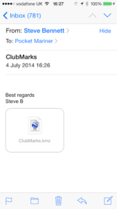
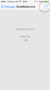
Open it in the iPhone email client. Here are screenshots of the final step of the import process:-
Open the email and tap the kmz icon.
Press the button at the top right to import the file.
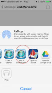
Select your flavor of SeaNav (UK, US ) from the list of options to open the file with:-
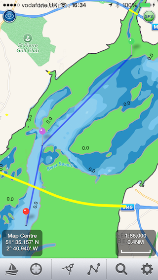
And there are the three waypoints in SeaNav:-
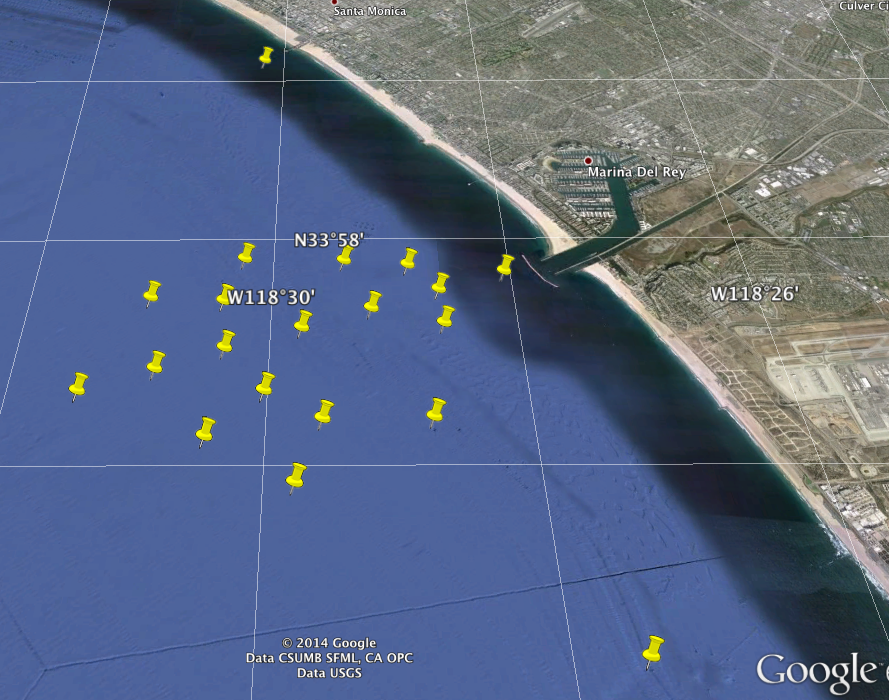
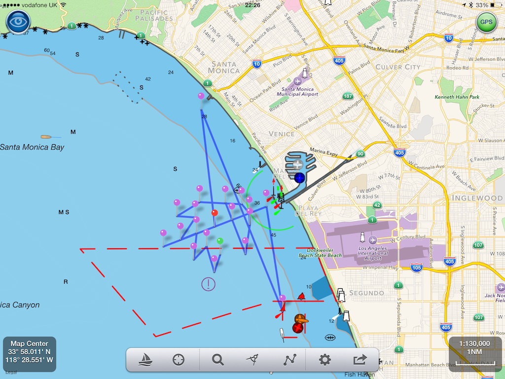
Here is a set of Club marks for the Marina Del Rey Yacht club created using the technique above and displayed in google earth and in SeaNav