Pocket  Mariner were invited to help NOAA with their new raster charts service. We met up with them in the US last year and have been working with them on the trial. NOAA’s Raster Navigational Charts (RNCs) are produced by NOAA’s Office of Coast Survey (OCS) and are designed for marine navigation, but can also be used as a marine base map by GIS users, coastal and ocean planning staff, and the general public. NOAA raster navigational charts (NOAA RNC®) are full-color digital images of NOAA paper charts. They provide a consistent view of the marine environment, but with more than 2,100 individual chart and inset files available, finding the right chart at the right scale can be time consuming.
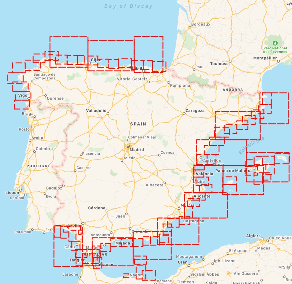
The trial aimed to create a map service of all 2,100+ raster navigational charts and their insets. The charts display as a seamless mosaic with the map collar or neat line—the information around the chart providing scale and notes—removed. Also, the map service displays only those charts appropriate for the viewing scale and map extent requested (from 1:5 million to 1:1,000 scale!). The seamless NOAA RNCs within the service are updated monthly and represent the most recent version of the RNCs and their respective Notice to Mariners at the time of the update.
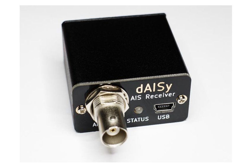
The trial has been a great success and we are now busy rolling out the new service to use in our Boat Beacon, SeaNav and Boat Watch apps via a simple In App Purchase. This gives our customers access to all 2,100 charts including all updates. The charts for a region automatically download when you view an area and we cache them locally on your device so that they display instantly the next time you look at the map and will also display when you are not connected to the internet. This also means customers using Boat Beacon as a display for external AIS receivers like Digital Yachts or the new and very competitively priced dAISy one ($59 – $41) can use Boat Beacon on their boat without needing an internet connection.
Boat Beacon on iOS is first out of the block with support for US NOAA raster charts. You can get it here :-
https://itunes.apple.com/app/boat-beacon-ais-marine-navigation/id494877039
Boat Watch iOS is next and we hope to have Boat Beacon on Android with US raster charts ready shortly following that. We can also add seamless raster chart options for the UK, Ireland, France, Netherlands and Germany – please let us know if you would be interested so we can raise the priority to get the work done – email us at support@pocketmariner.com or answer our quick 3 question survey here
https://www.surveymonkey.co.uk/r/8CFCWD2
If you want to check out what the charts look like for your area before getting them in our apps you can use the Raster Navigational Charts Google Earth Tool. This is a Google Earth file of all the charts and insets available and is updated monthly along with the map service updates. Clicking on a chart outline gives you information about that chart, such as title, scale, and date updated. Plus, you have the option to overlay in Google Earth a collared or a collarless version of the chart by clicking on the respective preview link.http://nosimagery.noaa.gov/rnc/NOAA_RNCs.kmz
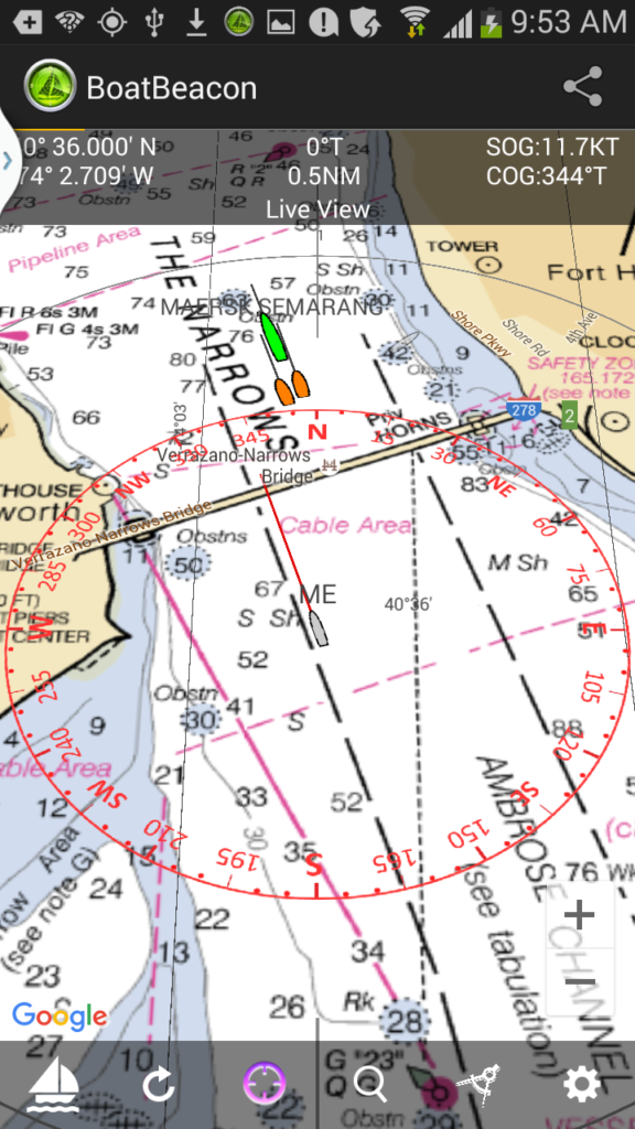
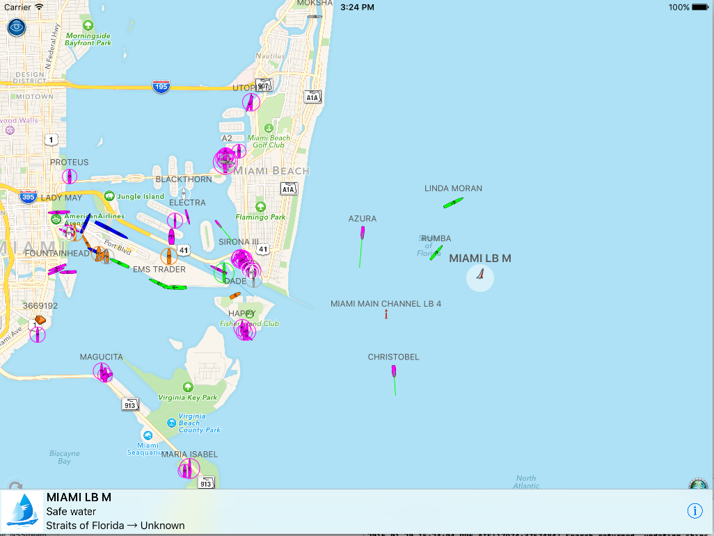
Here are some screen shots from Boat Beacon on an iPad with the US NOAA raster charts around Miami:-
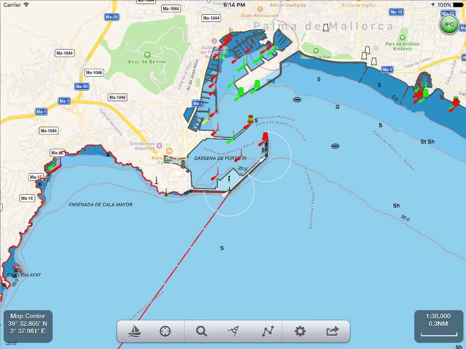
Pleasure Craft Azura selected (note the track in red and our unique trip detail feature which includes departure point as well as the standard destination info – Fort Lauderdale to Key West).

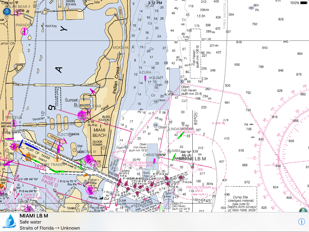
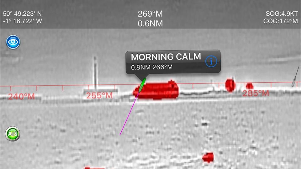
In this screenshot we have tapped on the mid channel Safe Water mark Aid to Navigation (AIS AtoN) on the approach to Miami (MIAMI LB M). All AtoN’s which have AIS available are selectable on the charts and will show distance and bearing from your location.
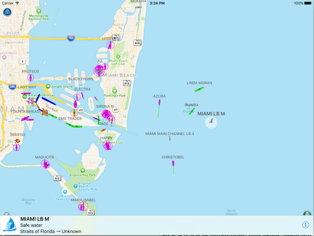
You can instantly toggle the charts on and off:-


 a dual channel VHF AIS receiver for under $35? Now there is one thanks to our

 Start the driver with the pink floating action button.